Landowner Maps for Bradford County
Our goal at Ancestor Tracks is to publish maps and land ownership information allowing researchers to pinpoint where our ancestors lived. The state of Pennsylvania began platting the exact metes-and-bounds tracts of the earliest landowners, township-by-township, starting in 1907. They only completed these Warrantee Maps for about 1/3 of the land mass of Pennsylvania, and Bradford County is one of the completed counties. The Pennsylvania Archives has been so kind as to post these images online (scroll below for links to these Bradford County Township Warrantee Maps).
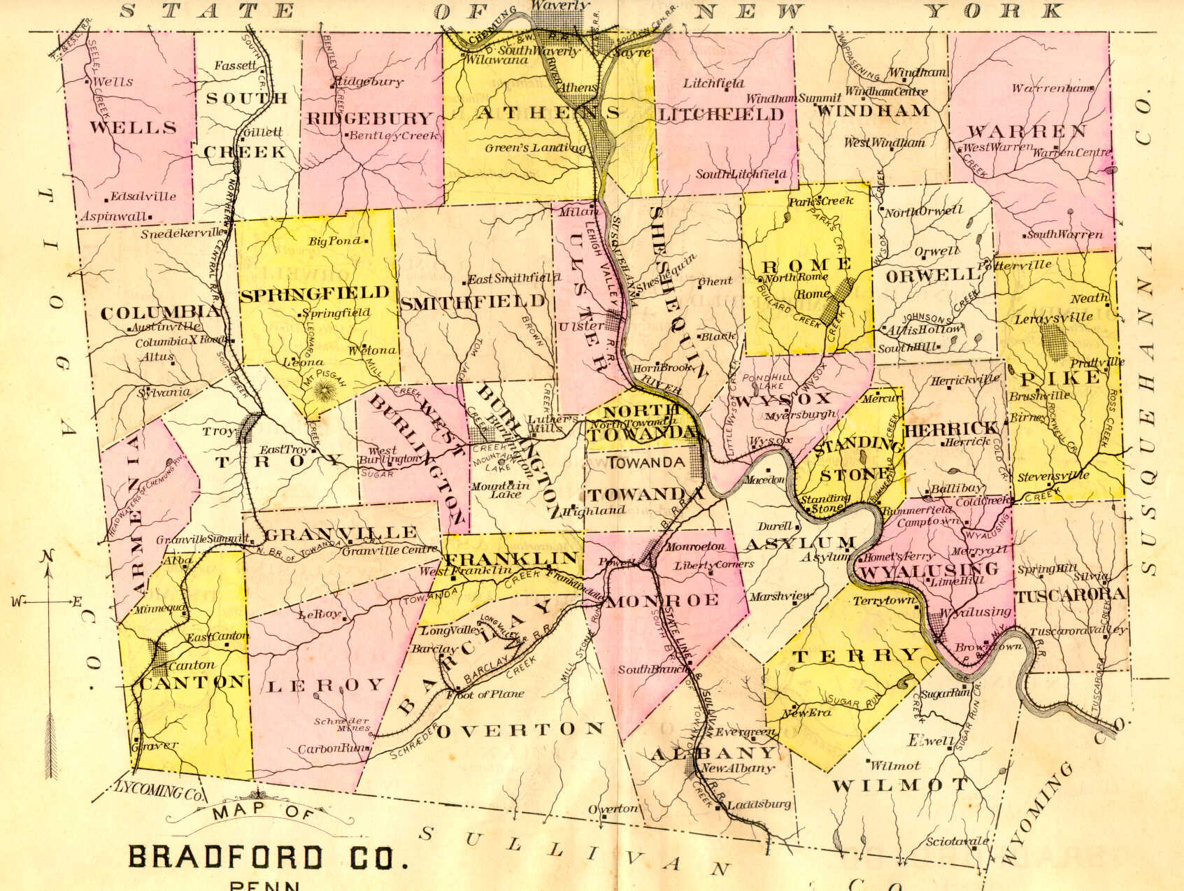
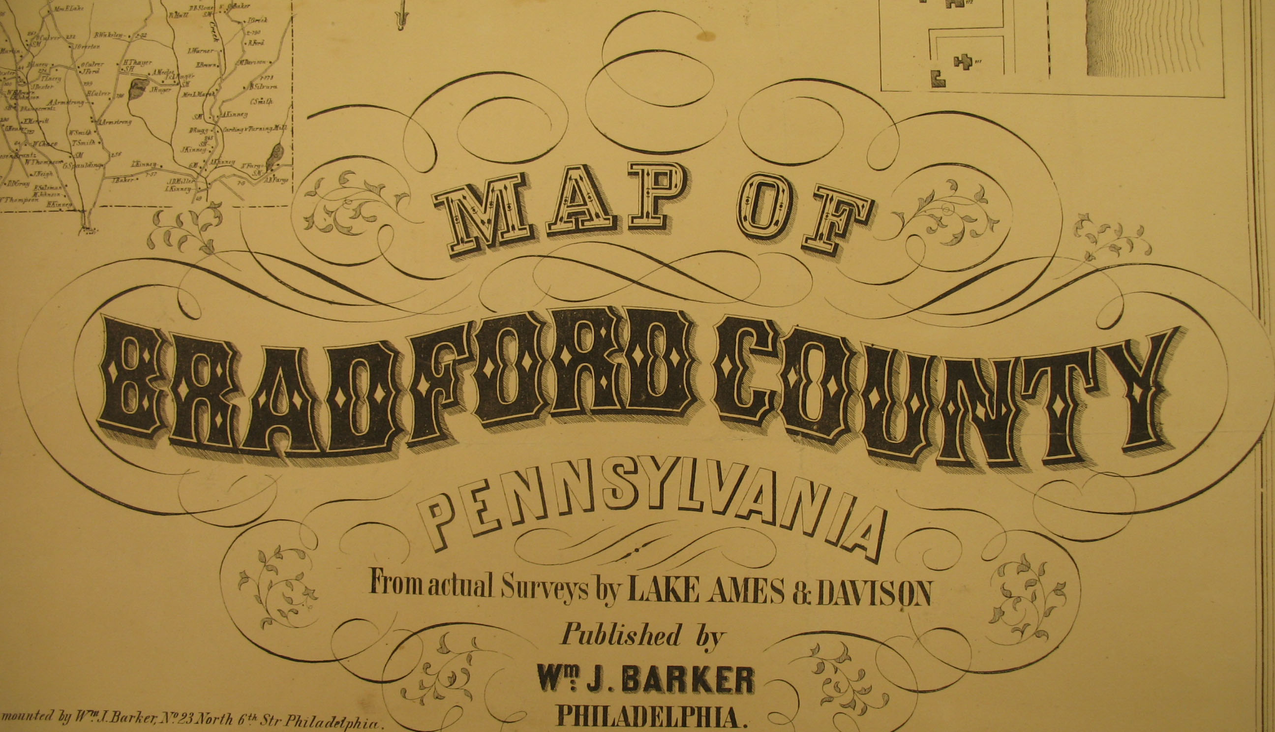
In addition to links to the Warrantee Maps, we are posting free, downloadable images from Map of Bradford County, Pennsylvania, From Actual Surveys by Lake Ames & Davidson (Philadelphia: Wm. J. Barker, 1858). We hope this landowner map will be useful when coupled with the 1860, 1870 and 1880 censuses and published county histories such as the 1891 History of Bradford County, Pennsylvania by H. C. Bradsby. An outstanding resource to use in conjunction with the map is Mark Daly's transcription of the names on many townships contained on the 1858 Landowner Map. There are a number of townships still to be transcribed, and we're sure he could use your help now that you can see (and download) the images below.
For researchers interested in this area, be sure to check out Joyce Tice's stunningly comprehensive website Tri-Counties Genealogy & History which contains, as she writes, "17,000 pages of resource materials and tools for Tioga and Bradford Counties in PA and Chemung County in NY." One tool for finding the evolution of today's townships, for example, is an 1812 map of Bradford County showing the townships as they were at that time. Two county histories can be found on her site: History of Bradford County, Pennsylvania with Illustrations and Biographical Sketches of Some of its Prominient Men and Pioneers by Rev. David Craft (Philadelphia: Everts & Co., 1878; be sure to read Chapter II "Land Controversies" to learn about the Connecticut Claims) and the aforementioned History of Bradford County, Pennsylvania, with Biographical Sketches by H. C. Bradsby, 1891. Other publications in her "Tri-Counties Online Research Library" include military histories, township histories, historic newspapers, and a myriad of other resources.
Please note that this 1858 landowner map, on file in the Library of Congress, is in the public domain but the images we have taken belong to us and are not to be used for commercial use. For those wishing to use them for personal use (including illustrating a family history you are working on), we give permission to use them, but we would appreciate attribution to Ancestor Tracks. It takes much time and effort to locate, process, and post these and the many other county images we have posted, so we expect and appreciate this courtesy.
Click on the township of your choice and once they have downloaded completely, click on them again to enlarge and clarify them. They may be saved to your computer by right-clicking and selecting "Save Image As..."
 |
Township | Albany Township Armenia Township Asylum Township Athens Township Barclay (created in 1867 and owned by the Towanda Coal Company and Barclay RR company) Burlington Township Canton Township Columbia Township Franklin Township Durell Township(Formed in 1842 from Monroe & Asylum, but disbanded in 1850s) Granville Township Herrick Township Leroy Township Litchfield Township Monroe Township North Towanda Township Orwell Township Overton Township Pike Township Ridgebury Township Rome Township Sheshequin Township Smithfield Township South Creek Township Springfield Township Standing Stone Stevens Township (formed from Pike Twp. in 1926) Terry Township (created from Asylum Township in 1859) Towanda Township Troy Township Tuscarora Township (formerly called Spring Hill) Ulster Township Warren Township Wells Township West Burlington Township Wilmot Township Windham Township Wyalusing Township Wysox Township |
| Boroughs, Towns and Villages | |
As mentioned above, the Warrantee Maps for each township which were drafted by the Pennsylvania Land Office have been scanned and posted online by the Pennsylvania Archives. Paper copies of each map can be ordered from the Archives as well.
| Bradford Co. Township Warrantee Maps Repository: Pennsylvania Archives, Harrisburg |
Township | Albany Armenia Asylum Athens Barclay Burlington Canton Columbia Franklin Granville Herrick Leroy Litchfield Monroe North Towanda Orwell Overton Pike Ridgebury Rome Sheshequin Smithfield South Creek Springfield Standing Stone Stevens Terry Towanda Troy Tuscarora Ulster (not posted on web) Warren Wells West Burlington Wilmot Windham Wyalusing Wysox |
Click here to go to our order form.
Click here to go to our product page.
Click here to return to our home page.