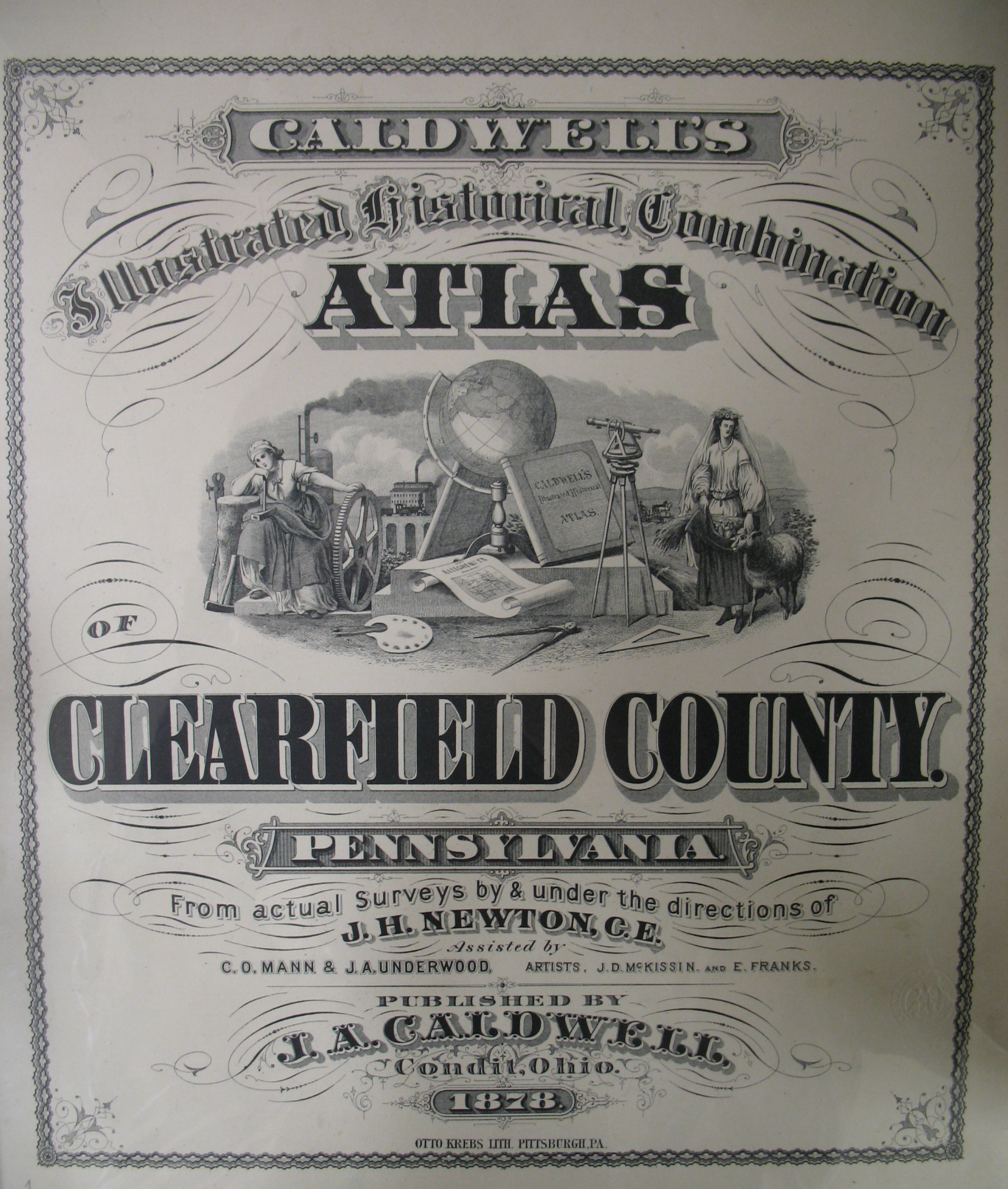
Our goal at Ancestor Tracks is to publish maps and land ownership information allowing genealogy researchers to geographically locate where our ancestors lived. The state of Pennsylvania began platting the exact metes-and-bounds tracts of the earliest landowners, township-by-township, starting in 1907, but they did not do a project for Clearfield County. However, a very industrious surveyor named Ed Heary completed an excellent map of the earliest landowners which we are posting below. We are also posting free, downloadable images from Caldwell's Illustrated Historical Combination Atlas of Clearfield County, Pennsylvania published by Caldwell in 1878. We hope they will be useful for pinpointing the whereabouts of residents in the 1850-1880 census records and those mentioned in History of Clearfield County, Pennsylvania by Lewis Cass Aldrich (1887). Another excellent resource for Clearfield is Twentieth Century History of Clearfield County, Pennsylvania, and Representative Citizens by Roland D. Swoope, Jr., 1911, and it appears that the full text has been placed online at Clearfield County PAGenWeb Archives by Judy Banja and Sally & Claire White. What a wonderful contribution to genealogy! Also, a downloadable copy of the entire book is online. Furthermore, the Clearfield County Genealogy Project hosted by Shirley Pierce and Nathan Zipfel has posted online another book, Clearfield County, Pennsylvania: Present and Past by Thomas Lincoln Wall, published in 1925.
The 1878 atlas which we are posting below is located in the Library of Congress. While the physical maps are in the public domain, the images that we have personally taken at the Library of Congress belong to us and are not to be used commercially. If you wish to use them for personal use (including illustrating a family history you are working on, or including one on your personal web page for which you do not charge), you may use them freely as long as you attribute them to Ancestor Tracks.
Click on the township of your choice. Once the images are loaded, they may appear to be illegible but they can then be enlarged and clarified by clicking on them. They may also be saved to your computer by right-clicking and selecting "Save Image As..." They may also, of course, be printed.

Click on the title page above to see the arrangement of townships |
|
| Township | |
Bigler Township (created 1883 from Beccaria/Gulich/Knox/Woodward) | |
Cooper Township (created 1884 from Morris Twp.) | |
Hunlock Township (created from Union & Plymouth, 1877) | |
Morris Township (included Cooper Twp. before 1884) | |
Pine Township (created 1873 from Lawrence) | |
Sandy Township (created 1878 from Brady & Huston) | |
Towns and Boroughs | |
Ed Heary's Warrantee Maps of Clearfield County
The state of Pennsylvania began platting the exact metes-and-bounds tracts of the earliest landowners, township-by-township, starting in 1907, but the Land Office only completed about 1/3 of the state before the project ended and did not cover Clearfield County. We are incredibly fortunate, however, that Edward J. Heary painstakingly created connected draft maps of the original owners of land in three counties in central Pennsylvania, thus performing a priceless service for genealogists. The project, which included mapping Clearfield, Centre and Clinton Counties, took him many years to accomplish. These maps show the boundaries of the tracts on topographic maps, warrantees of the tracts, and the survey number of each, so that the original surveys can be obtained from the Pennsylvania Archives in Harrisburg. It is our pleasure to present to you below images of Mr. Heary's maps which may be copied onto your personal computer. There is no index yet to the Heary maps of Clearfield County, but taking time to search the images can yield a great deal of information about the earliest settlers.
Once you have found your ancestor's name, you will see a hyphenated entry such as A19-121. This refers to the the Survey Book (A19) and page number (121) where the survey was recorded in Harrisburg. The Pennsylvania Archives in Harrisburg, under the direction of Jonathan Stayer, has posted images of both the front and back side of every page of the Copied Survey Books online. Check both the front and back of the relevant survey. Nearly all surveys show the date of the warrant, the name of the county as it then existed, the date of the survey, and the neighbors owning the surrounding tracts at the time of the survey. Many times there is additional information. Armed with these pieces of information, you can either search the warrants which have also been posted online by the Pennsylvania Archives or consult our CD which contains all 67 County Warrant Registers and which can be saved onto your computer for easy access in repositories where no internet connection is available. The entry in the Warrant Register will also give the name of the patentee and the Patent Register and Page Number where the patent can be found (posted online by the Pennsylvania Archives), or you can purchase our CD containing all of the state Patent Registers for use when the internet is not available. You can write for copies of the original documents from:
Pennsylvania Historical & Museum Commission
Pennsylvania State Archives
350 North Street
Harrisburg, PA 17120-0090
Their order form is online.
Please note that these land transfers predate the deed books located in each county because they deal with the first transfer of land to private individuals at the state level.
Once they have loaded, you may enlarge them by clicking on them (wait until they become clear); also, you may save them to your computer by right-clicking on the image and choosing "Save image as...."
| Clearfield Co. Township Warrantee Maps by Ed Heary | |
| East Clearfield County | |
| West Clearfield County | |
Click here to return to the Ancestor Tracks home page.
Click here to go to the Ancestor Tracks order form.
Click here to go to the Ancestor Tracks product page.