![]()
Venango County Resources for Use with 1860 and 1870 Census
Fortunately for Venango County researchers, the Pennsylvania Land Office completed excellent Township Warrantee Maps of Venango County and they have graciously posted them online. We are posting links to each of these warrantee maps below.
Our goal at Ancestor Tracks is to publish maps and land ownership information allowing researchers to place more precisely the locations where our ancestors lived. We are therefore posting images from two maps of Venango County, one published in 1857 and one published in 1865. These maps are located in the Library of Congress Geography and Map Division, Washington, D.C. We hope that they will be useful tools for locating your Venango County families when coupled with the 1860 and 1870 censuses. Once you click on an image and it is on your screen, it can usually be enlarged by clicking on the image, and it may be saved to your computer by right-clicking and selecting "Save Image As..."
Venango County was created from Allegheny and Lycoming Counties in 1800, and Lycoming was created from Northumberland in 1795. Allegheny was created from Westmoreland County in 1788. Thus, all of these counties should be checked for deeds and wills, etc. If your ancestor was actually a first landowner, purchasing his or her property from the colony or state of Pennsylvania, further information about these tracts may be gleaned from the Westmoreland, Allegheny, Lycoming, Venango or Northumberland County Registers contained on our CD, First Landowners of PA: Colonial and State Warrant Registers in the PA Archives, Harrisburg, 1682-ca 1940. Also see this site for a description of the Pennsylvania land acquisition process.
Map of Venango County Pennsylvania, Compiled from Official Surveys by R. Irwin, C. H. Heydrick, and C. Heydrick, published in 1857, located in the Library of Congress
We are also publishing images from Hunt's Improved Map of Venango County Oil Regions which was published by John P. Hunt in 1865. As always, once you click on an image and it is on your screen, it can be enlarged by clicking on the image, and it may be saved to your computer by right-clicking and selecting "Save Image As..."
Click here to return to the Ancestor Tracks home page.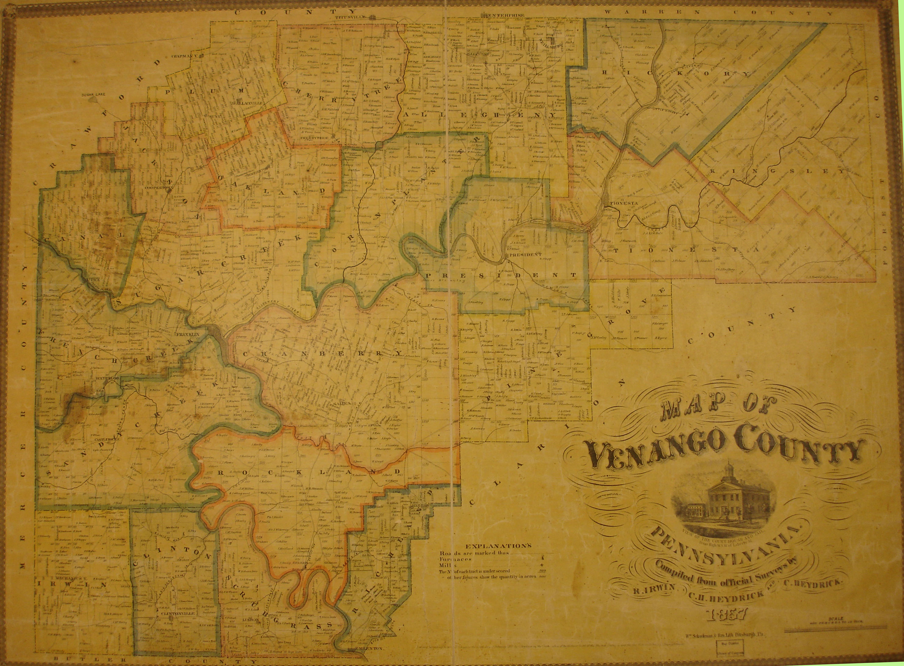
Once the images are loaded, they can be enlarged by clicking on them, and they may be saved to your computer by right-clicking and selecting "Save Image As..."
The Warrantee Maps on file at the Pennsylvania Archives can be accessed by clicking on the relevant township. We hope to transcribe the entire county, locate neighbors and possibly later landowners, and publish this as another volume in the Early Landowners of Pennsylvania series in 2011, but in the meantime they are available for anyone willing to search the images one by one. These are large files and will take time to download. Paper copies of these maps, some of which are 3' X 6', can be ordered from them.
Venango Co. Township Warrantee Maps
Township
Click here to go to the Ancestor Tracks order form.
Click here to go to the Ancestor Tracks product page.