Land Transfers from Virginia to Pennsylvania
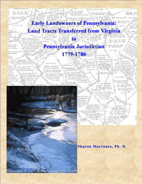
| There is a little bound notebook in the Pennsylvania Archives in Harrisburg which is untitled but which contains invaluable information regarding the earliest western Pennsylvania settlers. This weathered account book holds chronological entries by surveyors of the transfers of individual land tracts from Virginia jurisdiction to that of Pennsylvania in 1779-1780. These transfers were made necessary because two of His Majesty's colonies, Virginia (which then included West Virginia) and Pennsylvania, had engaged in a wrestling match over the territory. Pennsylvania eventually won when the Mason-Dixon Line was finalized, and Pennsylvania then gave surveys and patents "in pursuance of a Virginia certificate" to those who could prove they had received the land before the change in jurisdiction. Thus, when a Pennsylvania land tract states that it was received "under a Virginia certificate," its official transfer can almost always be found recorded in this book. This notebook was also transcribed and published in the Third Series of Pennsylvania Archives (Vol. III, pp. 483-573) in 1894 under William Egle's tutelage. It is a chronological listing by date of entry into the notebook-not the date a settler entered the land, but the date of the transfer of the land to Pennsylvania authorities. Unfortunately, there are some problems with the transcription printed in Pennsylvania Archives: some of the entries listed in the original notebook were omitted; many of the names were not transcribed exactly; and there is no alphabetical index to the list. Another omission is that hundreds of annotations have been added in the margins of the notebook in the 110 years since the transcription was originally published. In the original volume, about three-quarters of the tracts had some sort of identification for their locations in the fourth column, usually the stream or river on which they were located. Unfortunately, the surveyors sometimes used abbreviations or phonetic spellings which are unfamiliar to us today and which are impossible to locate on present-day maps. For example, while a researcher today could fairly easily figure out where "X Creek" was, someone unfamiliar with the area would find "Shirtie Creek" or "Tomlinson's Run" much harder to identify. And where on earth was "Wa. Monongh'a" or "Harm's Run" or "Adjoining Thos. Smallman Settlement Right"? And, of course, there was the little issue that about one-quarter of the tracts had no location designated at all. Because of these omissions and problems, this volume was initiated. The present volume is a long-needed revision of Egle's 1894 edition, complete with the following changes: all missing entries have been added; all names have been transcribed exactly as entered in the notebook; all of the marginal annotations have been included; and an everyname index has been incorporated. Additionally, every effort has been made to identify the location of the tracts which have no entry in the "Where Situate" column. Finally, maps have been added of the waterways to show the approximate location of the tracts. |
Click here to go to the order form.
Click here to go to the product page.
Click here to return to the home page.