![]()
Elk County
The colonial government under the Penns did not sell land until they received it through Indian treaties, and thus the land which would become Elk County was not available for purchase until the land was acquired through the Treaty of 1784 after the Revolutionary War. The vast area of northwest Pennsylvania was thus opened up for settlement through this "Last Purchase." About 20 of today's counties were originally part of this land. At first the price was set relatively high, and few tracts sold for that amount. In fact, a letter addressed by Benjamin Franklin to the Supreme Executive Council on 23 Feb 1787 says, "We are convinced that it will be of advantage to the State to lower the price of land within the late Indian purchase; only eight warrants have been taken out for lands these six months passed." (Colonial Records, vol. xv., pg. 167). The price of the land was thus duly reduced, and it was again reduced in 1792 because sales were not increasing much. Finally, the lower price induced many large land purchasers to apply for huge tracts. The Holland Land Company under Wilhelm Willink and 7 others living in Holland, for example, purchased 1105 warrants of 900 acres each, meaning that they controlled nearly a million acres east of the Allegheny River. Herman LeRoy and Jan Lincklean who were also living in Amsterdam acquired 303 warrants of 900 acres, or 272,700 acres. James Wilson bought 510 warrants containing 900 acres each which totaled 451,000 acres. John Nicholson bought 300 warrants containing 1,000 acres each, for a total of 300,000 acres. Thomas M. Willing bought 311,000 acres; George Meade purchased 306,000 acres, etc.
The 1855 landowner map below shows the tracts as they existed at that time with notations on each tract giving the acreage and an abbreviation of the warrantee's name. The Land Office clearly used this map, in conjunction with the Last Purchase Warrant Register, to create the Warrantee Township Maps which are below the 1855 map. For example, the upper left-hand corner of the Benezet (or Benezette) Township map of 1855 indicates that Tract #4994 containing 495 acres was warranted by "W.W." or Wilhelm Willinck. Page 62 under "Surnames beginning with 'W' in the Last Purchase Warrant Register yields the information that Wilhelm Willink and others warranted the tract on 3 Feb 1794; that the survey containing 990 acres was returned for patenting to him on 25 Sep 1799; that the survey is recorded in Survey Book A12, pg. 290; and that the patent is recorded in Patent Register P42, pg. 153. All of this information is shown on the Warrantee Map prepared by the Land Office, with the exception of the Survey Book information. The Last Purchase Warrant Register, where the tract numbers are entered sequentially, reveals that the survey was recorded in Copied Survey Book A12, pg. 290. The Patent Register shows that the tract was given the name "Ash Grove," gives the patent date as 7 Oct 1799, and confirms the warrant date as 3 Feb 1794.
So how is a researcher following ancestors in Elk County to find the original survey? It will be necessary to work backwards from the most recent transaction regarding the tract to these Warrantee Maps and Survey Books. The warrants which were purchased under the Last Purchase are recorded at the Pennsylvania Archives in Harrisburg (as are the original surveys), but the deeds which were spawned by these warrants are on file in individual county courthouses. Since Elk County was not founded until 1843, it will be necessary to consult the land records in Elk's mother counties. Elk was created in 1843 from parts of what was then Clearfield, McKean and Jefferson Counties. Before McKean and Jefferson were created in 1804, Elk was part of Lycoming Co., and before 1795 it was part of Northumberland County. Depending on how early your ancestor settled in the area and the portion of Elk County that the land fell in, deeds for the specific piece of property may be filed in any one of those counties as the county boundaries changed around the tract. We are posting below images of the 1855 map to aid in your search since the 1855 map shows township lines, roads, names of creeks, railroads, and some towns which the Township Warrantee Maps do not.
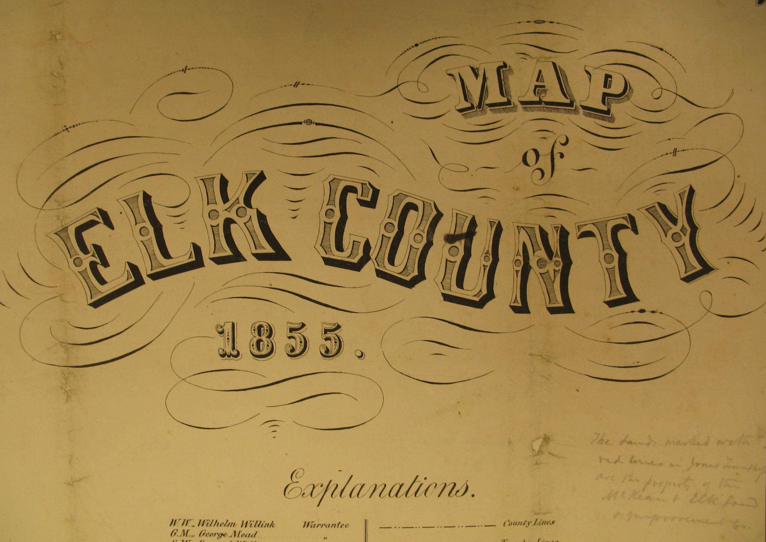 1855 Elk Co. Landowners |
|
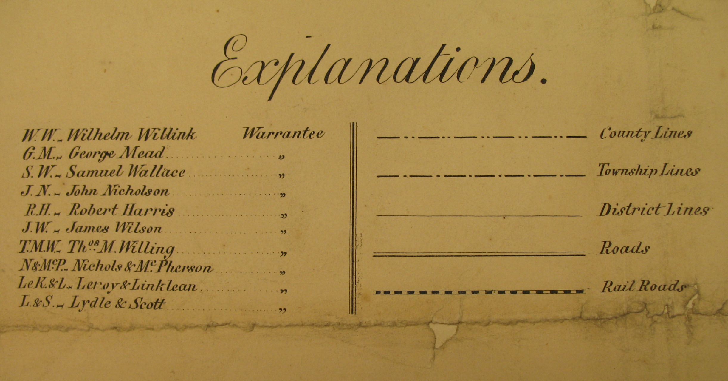 Key to Name Abbrebiations |
|
The following Township Warrantee Maps, showing the metes-and-bounds plats of the first landowners of the county, have been placed online by the Pennsylvania Archives in Harrisburg (the maps below are large and will take time to completely download). Paper versions of these maps are also available from the Archives.
| Elk Co. Township Warrantee Maps | |
Click here to return to the Ancestor Tracks home page.
Click here to go to the Ancestor Tracks order form.
Click here to go to the Ancestor Tracks product page.