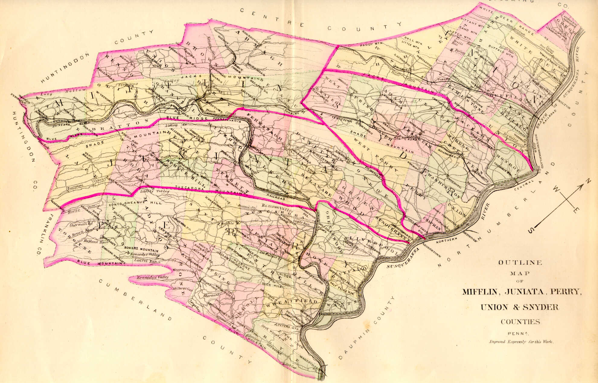
1886 Map of Townships of Mifflin, Juniata, Perry, Union & Snyder Counties from Everts, Peck & Richards
1886 Map of Townships of Mifflin, Juniata, Perry, Union & Snyder Counties from Everts, Peck & Richards
Our goal at Ancestor Tracks is to publish maps and land ownership information allowing genealogy researchers to pinpoint the locations where our ancestors lived. The state of Pennsylvania began platting the exact metes-and-bounds tracts of the earliest landowners, township-by-township, starting in 1907, but the Land Office only completed about 1/3 of the state before the project ended. Unfortunately, Pennsylvania did not plat the tracts of the earliest landowners of either Juniata or Mifflin Counties.
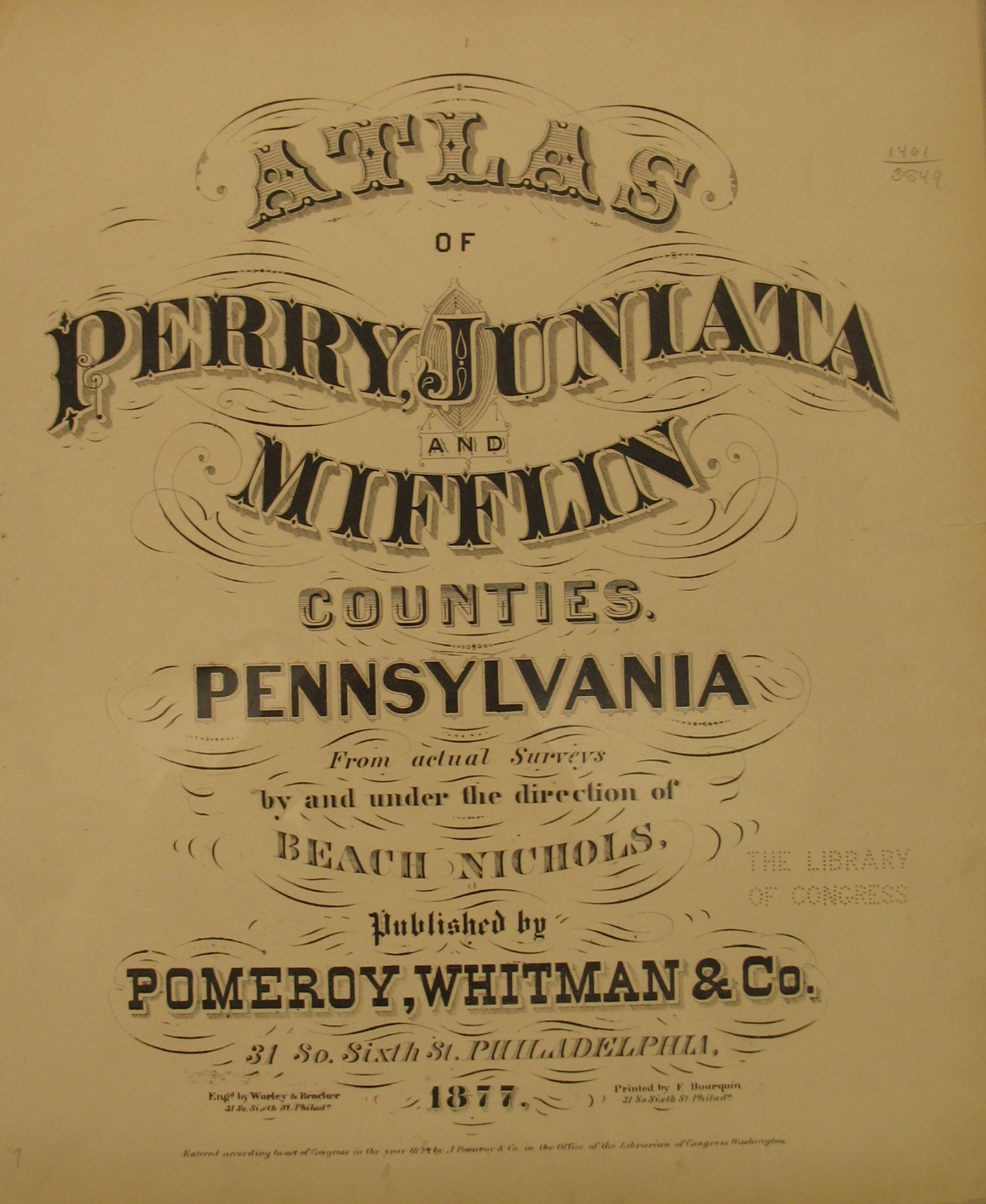
In lieu of being able to bring you Township Warrantee Maps of the earliest settlers of this area, we are posting images from Atlas of Perry, Juniata & Mifflin Counties Pennsylvania from Actual Surveys by and under the direction of Beach Nichols published by A. Pomeroy & Co. in 1877. This atlas is located in the Library of Congress Geography and Map Division, Washington, D.C. We hope that you will find it a useful tool for when coupled with the 1860, 1870 and 1880 census and published county histories.
All of the Mifflin County townships from this 1877 atlas have also been posted online through the sponsorship of The Mifflin County Historical Society in Lewistown. Many thanks to the volunteers who have been and are working on the genweb site! They have also posted many of the Juniata County Townships as well.
Please note that there is an excellent resource when using the 1877 atlas: Kelly Smith of Marysville, OH, has been working for years to produce an index for this atlas of all three counties, and she has completed all of the townships and nearly all of the towns. Amazingly, she has also transcribed the information found on the "Business Notices" pages which we are not posting. For example, one of the entries for Jackson Twp., Perry Co., reads thus: "Bower David, Proprietor Farmers’ and Drovers’ Hotel. Travelers will find this a desirable and pleasant Home. A limited number of boarders can be accommodated during the Summer. Location healthy and charges reasonable. Give Dave a Call. P.O. Blain." Thus, if a township or town image is too dark to read certain names, you may be able to locate the name in her index and then scan the map for something that looks similar.
Images of the 1877 atlas are below. Click on the township of your choice and once they have downloaded completely, click on them again to enlarge and clarify them. They may be saved to your computer by right-clicking and selecting "Save Image As..." These maps are in the public domain but if you use them from our website, we would appreciate attribution to Ancestor Tracks. It takes much time and effort to locate, process, and post these, and the many other county images we have posted, so we would really appreciate this courtesy.
Click here to return to the Ancestor Tracks home page.
Click here to go to the Ancestor Tracks order form.
Click here to go to the Ancestor Tracks product page.