Our goal at Ancestor Tracks is be a one-stop portal to published maps and land ownership information allowing researchers to place more precisely the locations where our ancestors lived.
Original Land Owners: The state of Pennsylvania began platting the exact metes-and-bounds tracts of the earliest landowners, township-by-township, starting in 1907. They only completed these Warrantee Maps for about 1/3 of the land mass of Pennsylvania, and Bradford County is one of the completed counties. The Pennsylvania Archives has been so kind as to post these images online (scroll below the 1858 map images for links to these Bradford County Township Warrantee Maps) but they are not indexed.
The draftsmen at the Pennsylvania Land Office used the Warrant and Patent Registers to create the Warrantee Maps. They searched each county and parent county, then each alphabetical section chronologically, in the set of 67 county Warrant Registers plus 3 pre-1733 ledgers called First Landowners of PA: Colonial and State Warrant Registers in the PA Archives, Harrisburg, 1682-ca 1940 ($35) saved to their computers. (Free images are also posted on the Pennsylvania State Archives website where each page of each county’s ledger is a separate pdf file). The Pennsylvania State Archives has posted the free
online surveys (check both front and back sides) and you can order copies of the original documents from the Pennsylvania State Archives in Harrisburg using their order form. The draftsmen also searched Pennsylvania’s index to Patent Registers ($35). Within an index covering the relevant years, the names are grouped alphabetically by the first letter of the patentee’s surname, then grouped by volume number of Patent Book, and finally arranged chronologically by date of patent. Thus, the entire alphabetical section must be searched (which may be as little as one page to as many as 50) so as not to miss anyone.
Most of what is now Bradford County was disputed between Pennsylvania and Connecticut until 1799 when Connecticut relenquished all claims to the Wyoming Valley. To learn about the Pennsylvania Land Acquisition process that England set up to distribute colonial land (which basically continues today), as well as the boundary disputes (between Pennsylvania and Maryland, Pennsylvania and Virginia, and Pennsylvania and Connecticut), Revolutionary War Donation and Depreciation land, and land opened through treaties with Indians, see our Land Acquisition page.
Before 1772, most of Bradford was included in Northampton County; then Northumberland County, which included today’s Bradford, was created 1772. Next, in 1786, Luzerne County, which included today’s Bradford, was created from Northumberland. You will have to go to or contact those counties for warrants, wills, deeds, etc., depending on when your ancestor settled here. Note: Bradford County was originally named Ontario County and renamed Bradford in 1812.
Please note that these land transfers predate the deed books located in each county because they deal with the first transfer of land to private individuals at the state level. Once the land passed into the hands of a private owner, any subsequent transfer of the land was recorded as deeds in the county courthouse as it existed at that time.
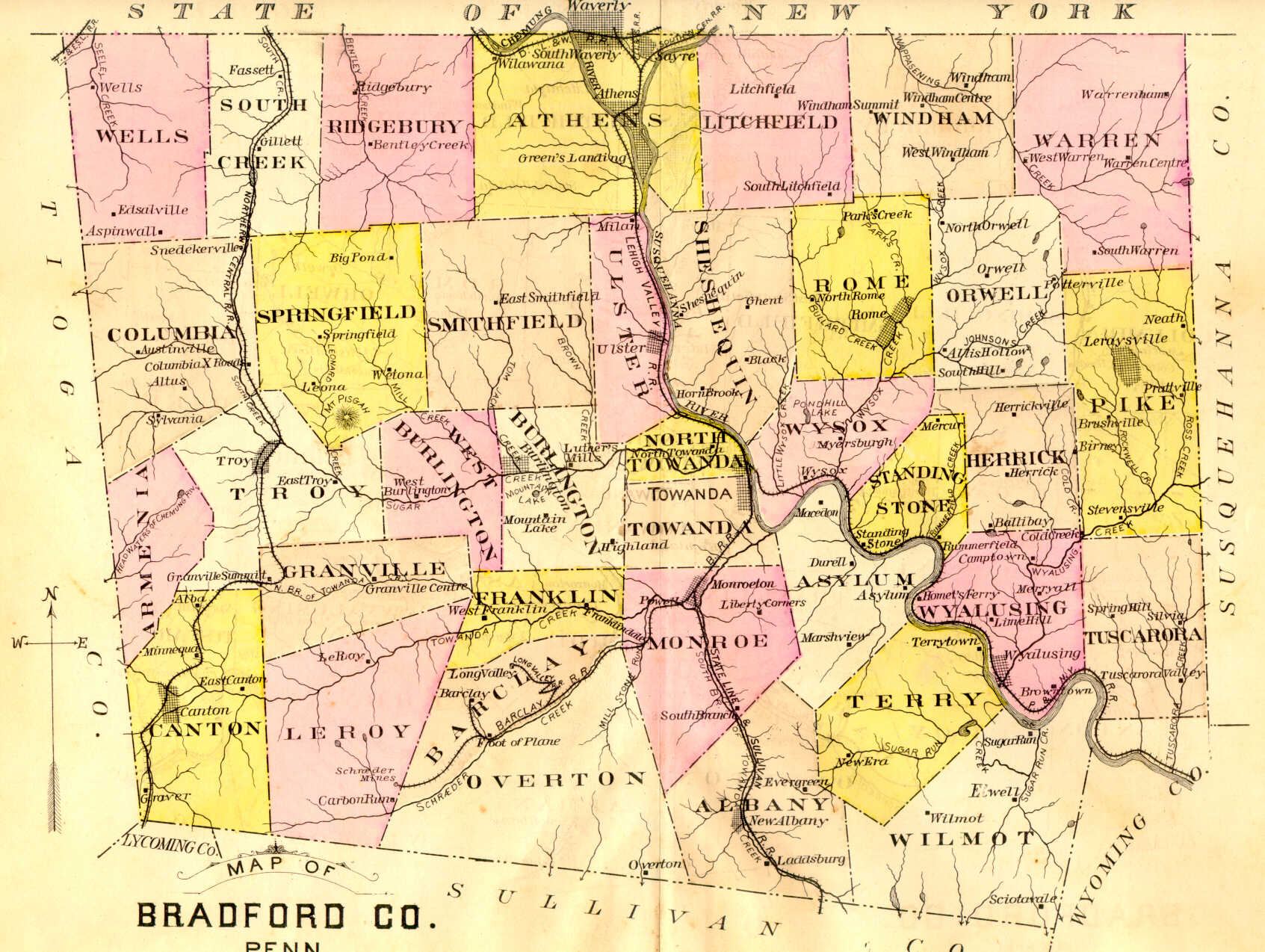
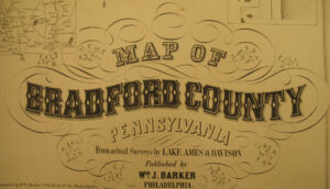
19th-Century Residents: In addition to links to the Warrantee Maps below, we are posting free, downloadable images from Map of Bradford County, Pennsylvania, From Actual Surveys by Lake Ames & Davidson (Philadelphia: Wm. J. Barker, 1858). We hope this landowner map will be useful when coupled with the 1860, 1870 and 1880 censuses and published county histories: David Craft’s 1878 History of Bradford County, Pennsylvania; John Sexton’s 1885 An Outline History of Tioga and Bradford Counties in Pennsylvania, Chemung, Steuben, Tioga, Tompkins and Schuyler in New York; Henry Bradsby’s 1891 History of Bradford County, Pennsylvania; and Clement Heverly’s 1926 History and Geography of Bradford County, Pennsylvania, 1615-1924.
Another outstanding resource to use in conjunction with the map is Mark Daly’s transcription of the names on many townships contained on the 1858 Landowner Map. There are a number of townships still to be transcribed, and we’re sure he could use your help now that you can see (and download) the images below.
For researchers interested in this area, be sure to check out Joyce Tice’s stunningly comprehensive website Tri-Counties Genealogy & History which contains, as she writes, “17,000 pages of resource materials and tools for Tioga and Bradford Counties in PA and Chemung County in NY.” One tool for finding the evolution of today’s townships, for example, is an 1812 map of Bradford County showing the townships as they were at that time. Two county histories can be found on her site: History of Bradford County, Pennsylvania with Illustrations and Biographical Sketches of Some of its Prominent Men and Pioneers by Rev. David Craft (Philadelphia: Everts & Co., 1878; be sure to read Chapter II “Land Controversies” to learn about the Connecticut Claims; the entire book is also posted at Internet Archive) and the aforementioned History of Bradford County, Pennsylvania, with Biographical Sketches by H. C. Bradsby, 1891 (images of all pages on Internet Archive). Other publications in her “Tri-Counties Online Research Library” include military histories, township histories, historic newspapers, and a myriad of other resources.