Our goal at Ancestor Tracks is to publish maps and land ownership information allowing genealogy researchers to place more precisely the locations where our ancestors lived.
Original Land Owners: The state of Pennsylvania began platting the exact metes-and-bounds tracts of the earliest landowners, township-by-township, starting in 1907, but the Land Office only completed about 1/3 of the state before the project ended. Unfortunately, Pennsylvania did not plat the tracts of the earliest landowners of Bedford County. However, Certified Genealogist Gerald “Jerry” Smith has created connected warrantee tract maps with indexes that he donated to the Pennsylvania Historical and Museum Commission (the Pennsylvania State Archives) for Snake Spring Township (#3928), Everett West Quad (map #3935), Clearville Quad and Rainsburg Quad (#3937).
If your ancestor was actually a first landowner in the county, purchasing his or her property from the colony or state of Pennsylvania, further information about these tracts may be gleaned from the count Warrant Registers and Patent Registers on file at the Pennsylvania State Archives in Harrisburg. The earliest land warrants were filed under the county as it existed at the time the warrant was issued.
The only way to find the date, book and page of the original warrant, survey, and patent for your ancestor is to search through those county Warrant Registers on the Pennsylvania State Archives website where each page of each county’s ledger is a separate pdf file, or download and save to your computer the entire set of 67 county Warrant Registers plus 3 pre-1733 ledgers called First Landowners of PA: Colonial and State Warrant Registers in the PA Archives, Harrisburg, 1682-ca 1940 ($35). Once you have found the information, you can access the free online surveys, and you can order copies of the original documents from the Pennsylvania State Archives in Harrisburg using their order form. Please note that these land transfers predate the deed books located in each county because they deal with the first transfer of land to private individuals at the state level.
If you cannot find an original landowner’s name in the Warrant Registers, the next place to look is in Pennsylvania’s index to Patent Registers ($35). Within an index covering the relevant years, the names are grouped alphabetically by the first letter of the patentee’s surname, then grouped by volume number of Patent Book, and finally arranged chronologically by date of patent. Thus, you have to look through the entire alphabetical section (which may be as little as one page to as many as 50) to be sure you don’t miss anyone.
See our explanation of how land was transferred from the government to individual owners from the earliest days of settlement.
19-Century Residents: The Atlas of Bedford County, Pennsylvania, published by F. W. Beers in 1877, has been scanned and images are posted by the Pennsylvania State Archives. Also, check out the circa 1860 map of Bedford County posted by Boston Public Library. Click on it and it will open in a new window where you can use your cursor to zoom in and see every detail.
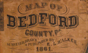
In lieu of being able to bring you Township Warrantee Maps of the earliest settlers, we are posting the first atlas of Bedford County that we are aware of, Map of Bedford County, PA Surveyed, Drawn & Published by E. L. Walker in 1861. If our images aren’t clear enough when enlarged, another version is posted at the Pennsylvania State Archives website. We hope that it will be a useful tool for locating your Bedford County families when coupled with the 1860 census and published county histories such as Rupp’s 1846 History and Topography of Dauphin, Cumberland, Franklin, Bedford, Adams, and Perry Counties , the 1884 History of Bedford, Somerset and Fulton Counties, Pennsylvania and the 3-volume History of Bedford and Somerset Counties published in 1906 (Volume I; Volume II; Volume III).