
Cameron County Land Resources
Our goal at Ancestor Tracks is to publish maps and land ownership information allowing researchers to place more precisely the locations where our ancestors lived.
Original Land Owners
The state of Pennsylvania began platting the exact metes-and-bounds tracts of the earliest landowners, township-by-township, starting in 1907, but the Land Office only completed about 1/3 of the state before the project ended. The original landowners of all five townships of Cameron county were platted by the Land Office and we have posted links to those maps below.
The draftsmen at the Pennsylvania Land Office used the Warrant and Patent Registers to create the Warrantee Maps. They searched each county and parent county (Cameron County was created in 1860 from portions of Clinton, Elk, McKean and Potter Counties, but it was part of Northumberland County before 1795 and then part of Lycoming County from 1795 to 1804), then each alphabetical section chronologically, in the set of 67 county Warrant Registers plus 3 pre-1733 ledgers called First Landowners of PA: Colonial and State Warrant Registers in the PA Archives, Harrisburg, 1682-ca 1940 ($35) saved to their computers. (Free images are also posted on the Pennsylvania State Archives website where each page of each county’s ledger is a separate pdf file). The Pennsylvania State Archives has posted the free online surveys (check both front and back sides) and you can order copies of the original documents from the Pennsylvania State Archives in Harrisburg using their order form. The draftsmen also searched Pennsylvania’s index to Patent Registers ($35). Within an index covering the relevant years, the names are grouped alphabetically by the first letter of the patentee’s surname, then grouped by volume number of Patent Book, and finally arranged chronologically by date of patent. Thus, the entire alphabetical section must be searched (which may be as little as one page to as many as 50) so as not to miss anyone. See our explanation of how land was transferred from the government to individual owners from the earliest days of settlement.
These land transfers predate the deed books located in each county because they deal with the first transfer of land to private individuals from Pennsylvania’s colonial or state government. Once the land passed into the hands of a private owner, any subsequent transfer of the land was recorded as deeds in the county courthouse as it existed at that time.
19th-Century Residents
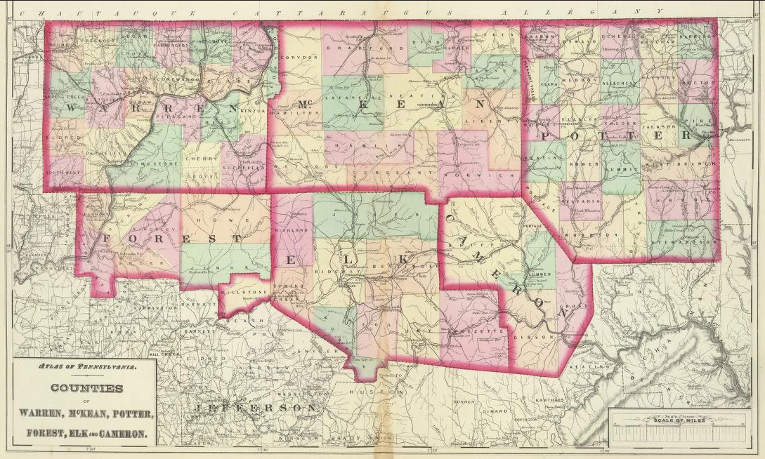
Unfortunately, no atlases or wall maps showing land owners for Cameron Co. are apparently in the Library of Congress, so we are unable to bring you those maps.
However, the Pennsylvania Archives has posted images of the 1870 Map of Cameron County, Pennsylvania from the Original and Recent Surveys by Edward Vosburg. Click on each of the four sections to enlarge them. Notice that these tracts correlate with the Warrantee Maps below which show details for the very first person to own that land (links to these are below). Thus, you can see the original owner of a particular tract and compare that with the owner on the 1870 map. Here is an example: If you click on the lower right panel of the four panels posted by the Archives and then enlarge it, you will see tract 5716 just to the left of the “C” in the “Cameron County” title. It is identified as “C.W. Md.” Now if you click on the Warrantee Map for Grove Township below and enlarge that map, you will see that tract 5716, containing 990 acres and allowance, was warranted to Casper Wister, Jr., on 31 Dec 1794. Wistar also had it surveyed 13 Feb 1795 and patented 21 Mar 1795; the patent is recorded in Patent Register P24, pg. 275. The 1870 owner is not shown on the Vosburg map but many of the other tracts do show a current owner.
The Cameron County Genealogy Project has also posted images from the 1870 map located in the Court House which show a few landowners.Be sure to check out the Cameron County Genealogy Project which is in the process of transcribing the relevant portion of History of the Counties of McKean, Elk, Cameron, and Potter, Pennsylvania published in 1890. The entire volume is also available at the Internet Archive. Also see McKnight’s 1905 A Pioneer Outline History of Northwestern Pennsylvania, Embracing the Counties of Tioga, Potter, McKean, Warren, Crawford, Venango, Forest, Clarion, Elk, Jefferson, Cameron, Butler, Lawrence, and Mercer.
Cameron County Warrantee Maps
The following Township Warrantee Maps have been posted by the Pennsylvania Archives in Harrisburg. These are large files and will take some time to load, so patience is required. Depending on your internet connection, your screen may appear to be blank while the pdf file is downloaded.
Township
| Gibson (7.5 mg) |
| Grove (3.5 mg) |
| Lumber and Portage (3.2 mg) |
| Shippen (5 mg) |