
Carbon County Resources
Ancestor Tracks is committed to becoming a one-stop resource for researchers of early Pennsylvania landowners. In addition to publishing our own books, we are posting images of 19th century maps and atlases that we personally took in the Library of Congress. Our goal is to post landowner maps, or links to other websites with landowner maps, for every county in the state.
Original Land Owners: The state of Pennsylvania began platting the exact metes-and-bounds tracts of the earliest landowners, township-by-township, starting in 1907, but the Land Office only completed about 1/3 of the state before the project ended. Unfortunately, Pennsylvania did not plat the tracts of the earliest landowners of Carbon County.
However, we are exceedingly fortunate that the 1875 atlas (see below) included maps showing the names of the warrantees, or very first landowners of Carbon Co.
The only way to find the date, book and page of the original warrant, survey, and patent for your ancestor is to search through those county Warrant Registers on the Pennsylvania State Archives website where each page of each county’s ledger is a separate pdf file, or download and save to your computer the entire set of 67 county Warrant Registers plus 3 pre-1733 ledgers called First Landowners of PA: Colonial and State Warrant Registers in the PA Archives, Harrisburg, 1682-ca 1940 ($35). Once you have found the information, you can access the free online surveys, and you can order copies of the original documents from the Pennsylvania State Archives in Harrisburg using their order form. See our explanation of how land was transferred from the government to individual owners from the earliest days of settlement.
If you cannot find an original landowner’s name in the Warrant Registers, the next place to look is in Pennsylvania’s index to Patent Registers ($35). Within an index covering the relevant years, the names are grouped alphabetically by the first letter of the patentee’s surname, then grouped by volume number of Patent Book, and finally arranged chronologically by date of patent. Thus, you have to look through the entire alphabetical section (which may be as little as one page to as many as 50) to be sure you don’t miss anyone.
Please note that these land transfers predate the deed books located in each county because they deal with the first transfer of land to private individuals at the state level. Once the land passed into the hands of a private owner, any subsequent transfer of the land was recorded as deeds in the county courthouse as it existed at that time.
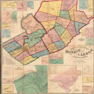
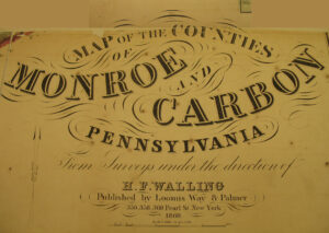
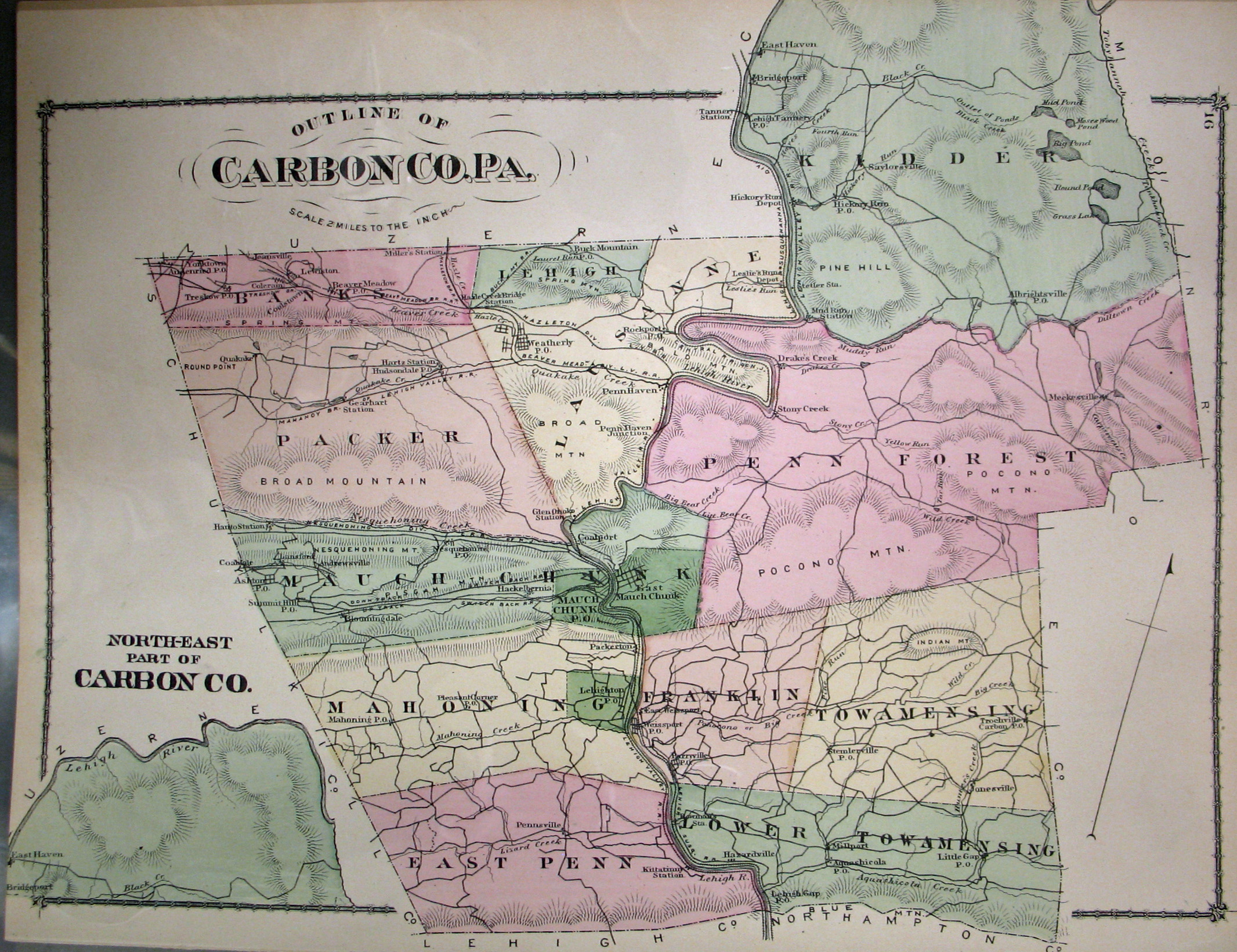
19th-Century Residents: We are posting free, downloadable images of two 19th-century landowner maps: (1) Map of the Counties of Monroe and Carbon, Pennsylvania From surveys under the direction of H. F. Walling (New York, 1860) (another version of this map is posted by the Leventhal Map Collection of Boston Public Library); and (2) County Atlas of Carbon, Pennsylvania From actual surveys by and under the direction of F. W. Beers published by Beers in 1875. We hope the images will be useful for pinpointing the whereabouts of residents in the 1850-1880 census records and those mentioned in History of the Counties of Lehigh and Carbon, in the Commonwealth of Pennsylvania by Alfred Mathews (1884). Also be sure to check out the comprehensive site on Carbon County History and Genealogy maintained by Jack Sterling–do not miss this site!
Carbon County Wall Map, 1860
While the map in the Library of Congress, is in the public domain the images we have taken belong to us and are not to be used for commercial use. For those wishing to use them for personal use (including illustrating a family history you are working on), we give permission to use them, but we would appreciate attribution to Ancestor Tracks. It takes much time and effort to locate, process, edit, and post these and the many other county images we have posted, so we appreciate this courtesy.
Township Maps
Banks Township
East Penn Township
Franklin Township
Kidder Township
Lausanne Township (now Lausanne, Lehigh, and Weatherly)
Lower Towamensing Township
Mahoning Township
Mauch Chunk Township (now Jim Thorpe, Nesquehoning, and Summit Hill)
Packer Township
Penn Forest Township
Towamensing Township
Boroughs, Towns and Villages
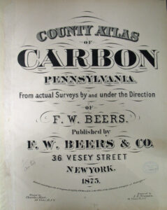
The following images are of County Atlas of Carbon, Pennsylvania, From actual surveys by and under the direction of F. W. Beers published in 1875. Jack Sterling has compiled an amazing index to this atlas and published it online. What a gift to Carbon County researchers!
Click on the township of your choice below. Once the images are loaded, they can be enlarged by clicking on them. If an image doesn’t enlarge, right-click on it and choose “Open Image in New Tab.” When it is opened in a new tab, you will be able to zoom in. You can also save the images.
While the map in the Library of Congress, is in the public domain the images we have taken belong to us and are not to be used for commercial use. For those wishing to use them for personal use (including illustrating a family history you are working on), we give permission to use them, but we would appreciate attribution to Ancestor Tracks. It takes much time and effort to locate, process, edit, and post these and the many other county images we have posted, so we appreciate this courtesy.
Business Index
Township Maps
Boroughs, Towns, and Villages
Warrantees (see explanation below)
Banks Township
East Penn Township
Franklin Township
Kidder Township
Lausanne Township (now Lausanne, Lehigh and Weatherly)
Lehigh Township
Lower Towamensing Township
Mahoning Township
Mauch Chunk Township (now Jim Thorpe, Nesquehoning, and Summit Hill)
Packer Township
Penn Forest Township
Towamensing Township
Ashton & Lansford Station
Audenried/Yorktown
Beaver Meadow
Bowmans Station
Buck Mountain
Hazardville
Bridgeport, East Haven, Lehigh Tannery, Sailorsville (Kidder Twp.)
Lehigh Gap
Lehighton
Mauch Chunk (northeast portion)
Mauch Chunk (western portion
Millport
Nesquehoning
Packerton
Parryville
Pennsville
Rockport
Summit Hill
Weissport
Yorktown/Audenried
Tutorial: The warrantee map shows the outlines of the first landowners of Carbon County (those people who purchased their tract directly from the colony or state of Pennsylvania). It takes a little work to locate the Survey Book and page number so that you can see them, however. There were three steps in the land acquisition process (after the application was made):
(1) a warrant was issued after a fee was paid, allowing the holder of the warrant (the warrantee) full use of the land;(2) a survey was made by a deputy surveyor after a second fee was paid; and (3) a patent (or final title) was issued upon receipt of a third fee. Many years can separate the three steps, and very often the land was sold or inherited before it was patented. Thus, the warrantee may not be the same as the patentee.
Use the following steps:
(1) The Warrant Register for the relevant county (most of the earliest purchases occurred while Carbon Co. was part of Northampton County) is the most important resource for locating the warrants, surveys and patents for the original tracts transferred from the colony or state to private owners. The vast majority of warrants are recorded in these ledgers.
(2) Look first in the Warrant Register for Northampton County (Carbon County was created from Northumberland Co. in 1843, but nearly all of the earliest landowners purchased before that time). Entries are arranged by the first letter of a person’s surname, and then entered in a roughly chronological order by warrant date. Page through the alphabetical section until you find your ancestor.
(3) Every fact recorded in the Warrant Register can yield an original warrant, survey and patent. The “Copied Survey Books” into which the original survey was copied are online (the warrants, patents and original surveys are not). The Survey Book and page number is recorded in the two columns at the far right of each Warrant Register. For example, if the desired survey is in A62, pg. 152, go to the Copied Survey Books. Click on the hyphenated volume number (in this case, A-62), and then click on the page number (in this case, A-62-152). The original survey can be ordered from the Archives–be sure to specify that you want an original!
(4) If you do not find the person of interest in the Northampton (or Carbon) Warrant Register, check the East Side Applications Register Index
(5) If you wish to order the warrant and patent from the Pennsylvania Archives, send them the information found for the rest of the Warrant Register entry.