Ancestor Tracks is committed to becoming a one-stop resource for researchers of early Pennsylvania landowners. In addition to publishing our own books, we are posting images of 19th century maps and atlases that we personally took in the Library of Congress. Our goal is to post landowner maps, or links to other websites with landowner maps, for every county in the state.
Original Land Owners
The state of Pennsylvania began platting the exact metes-and-bounds tracts of the earliest landowners, township-by-township, starting in 1907, but the Land Office only completed about 1/3 of the state before the project ended. Unfortunately, Pennsylvania did not plat the tracts of the earliest landowners of Franklin County. See our explanation of how land was transferred from the government to individual owners from the earliest days of settlement.
The only way to find the date, book and page of the original warrant, survey, and patent for your ancestor is to search for him or her in the correct alphabetical section and then chronologically through county Warrant Registers on the Pennsylvania State Archives website where each page of each county’s ledger is a separate pdf file, or download and save to your computer the entire set of 67 county Warrant Registers plus 3 pre-1733 ledgers called First Landowners of PA: Colonial and State Warrant Registers in the PA Archives, Harrisburg, 1682-ca 1940 ($35). Once you have found the information, you can access the free online surveys, and you can order copies of the original documents from the Pennsylvania State Archives in Harrisburg using their order form. Please note that these land transfers predate the deed books located in each county because they deal with the first transfer of land to private individuals from Pennsylvania’s colonial or state government. Franklin County was formed from Cumberland County in 1784. Cumberland was created from Lancaster County in 1750 and in turn, Lancaster County was created from Chester County in 1728.
If you cannot find an original landowner’s name in the Warrant Registers, the next place to look is in Pennsylvania’s index to Patent Registers ($35). Within an index covering the relevant years, the names are grouped alphabetically by the first letter of the patentee’s surname, then grouped by volume number of Patent Book, and finally arranged chronologically by date of patent. Thus, you have to look through the entire alphabetical section (which may be as little as one page to as many as 50) to be sure you don’t miss anyone.
Please note that these land transfers predate the deed books located in each county because they deal with the first transfer of land to private individuals from Pennsylvania’s colonial or state government. Once the land passed into the hands of a private owner, any subsequent transfer of the land was recorded as deeds in the county courthouse as it existed at that time.
19th-Century Residents
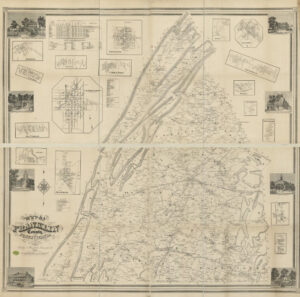
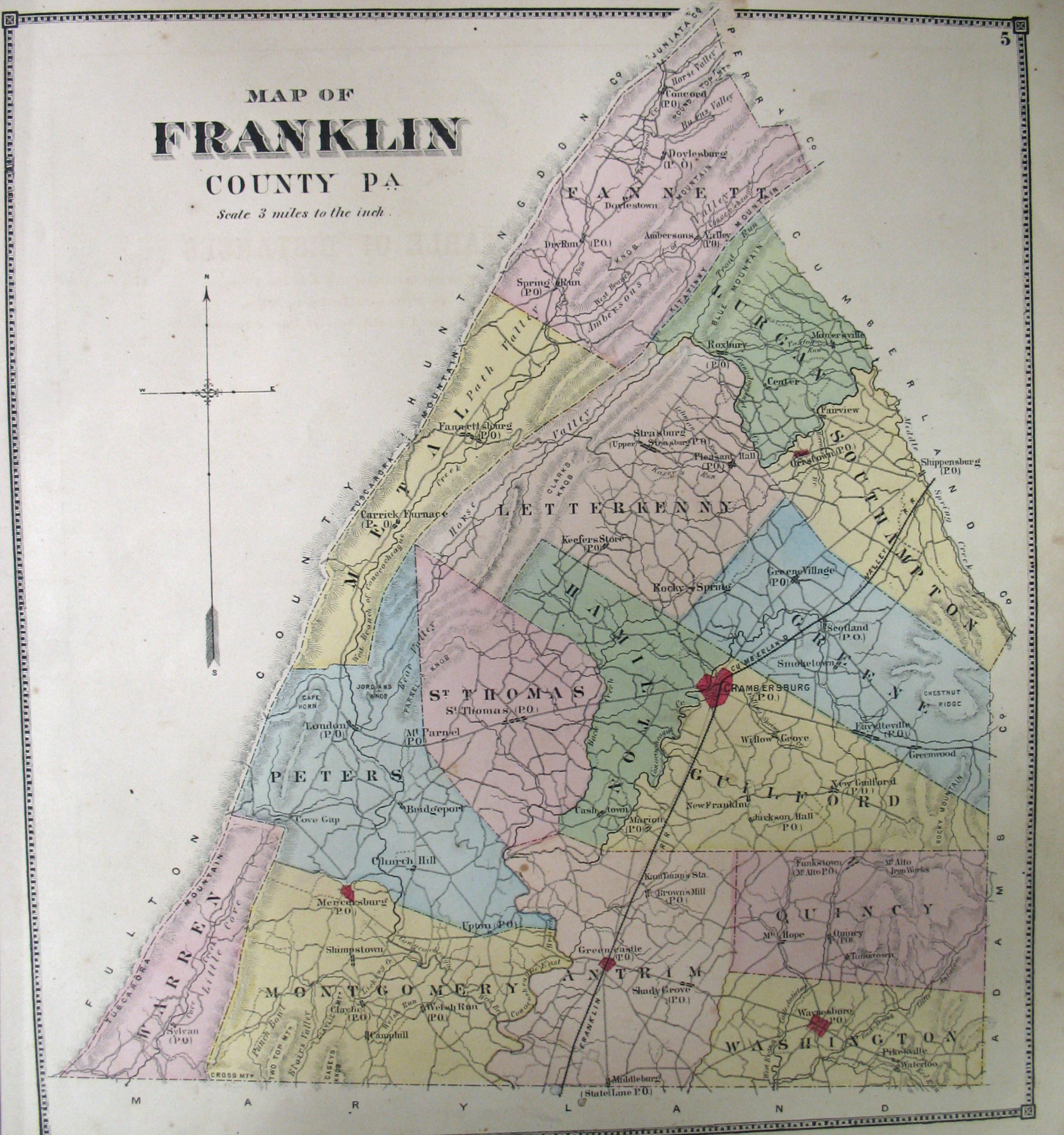
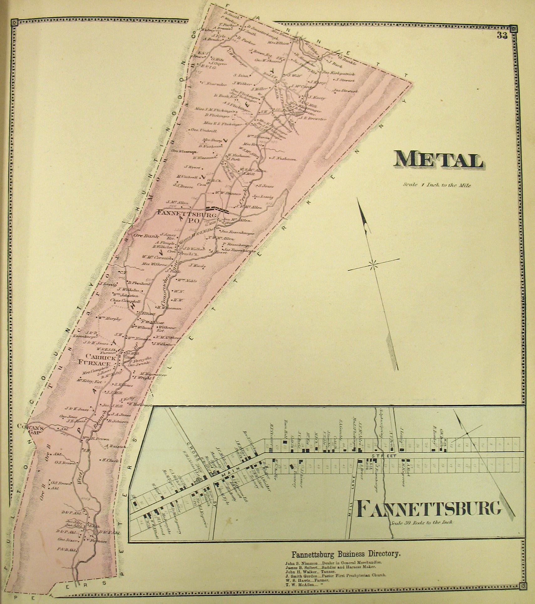
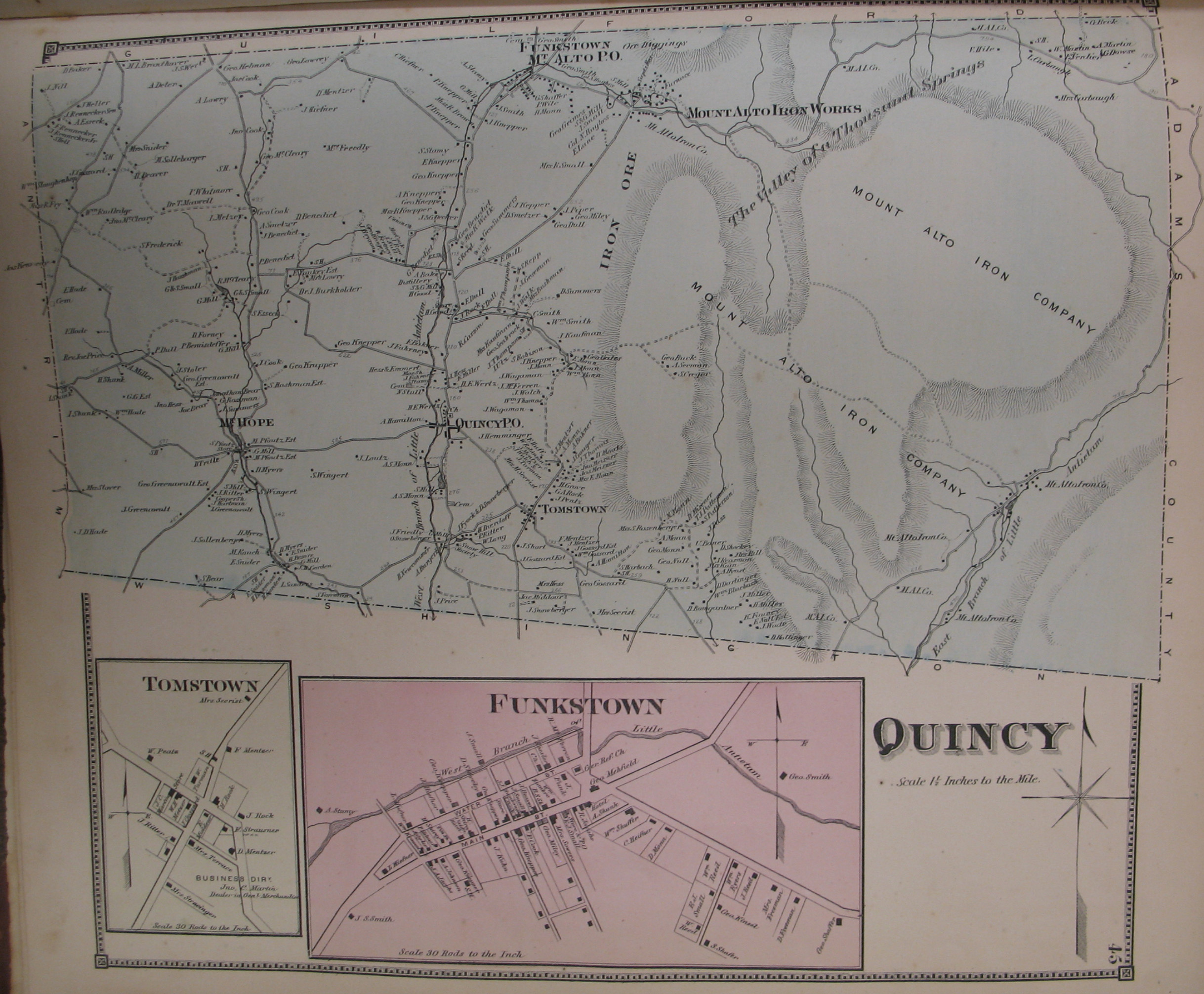
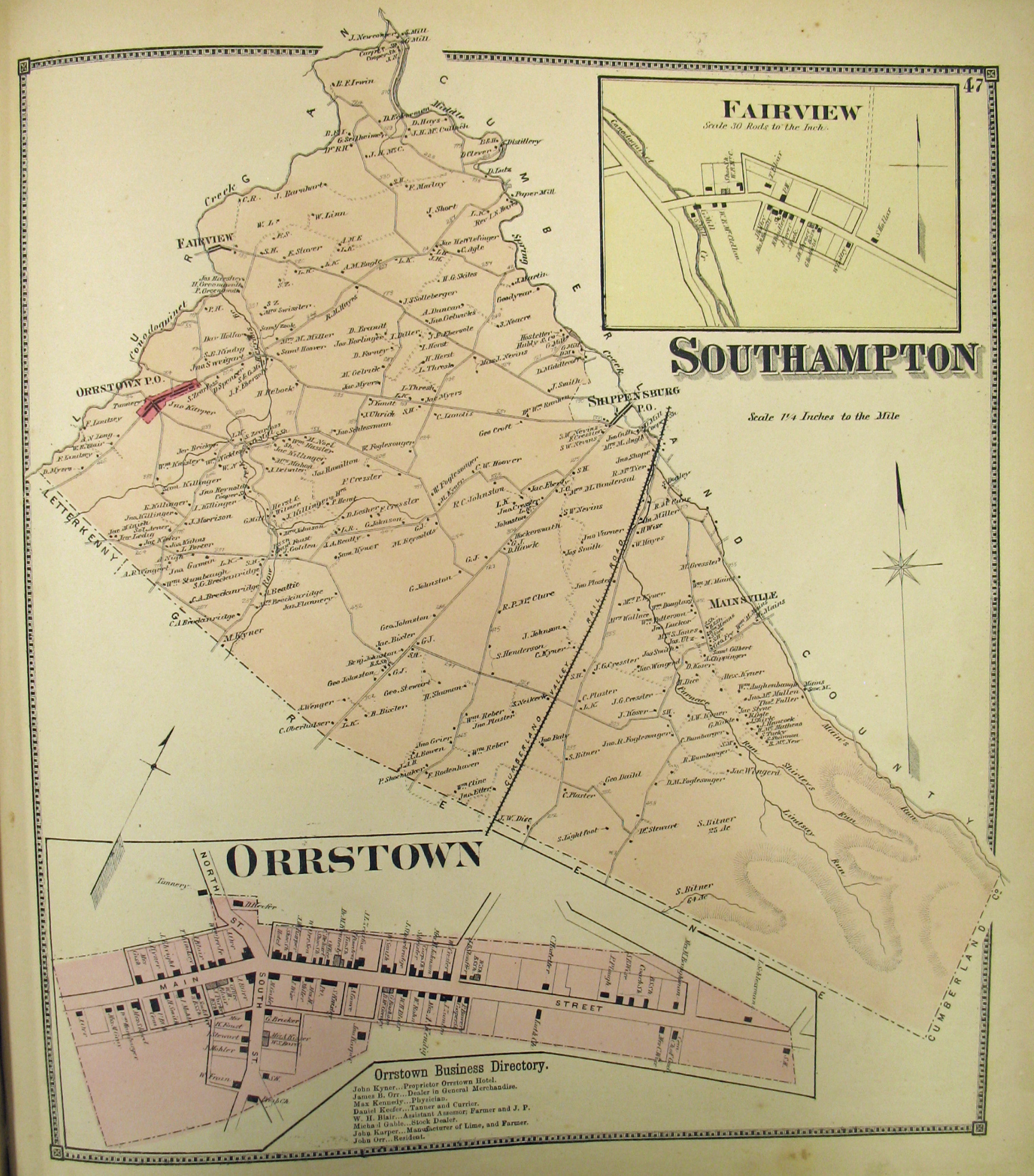
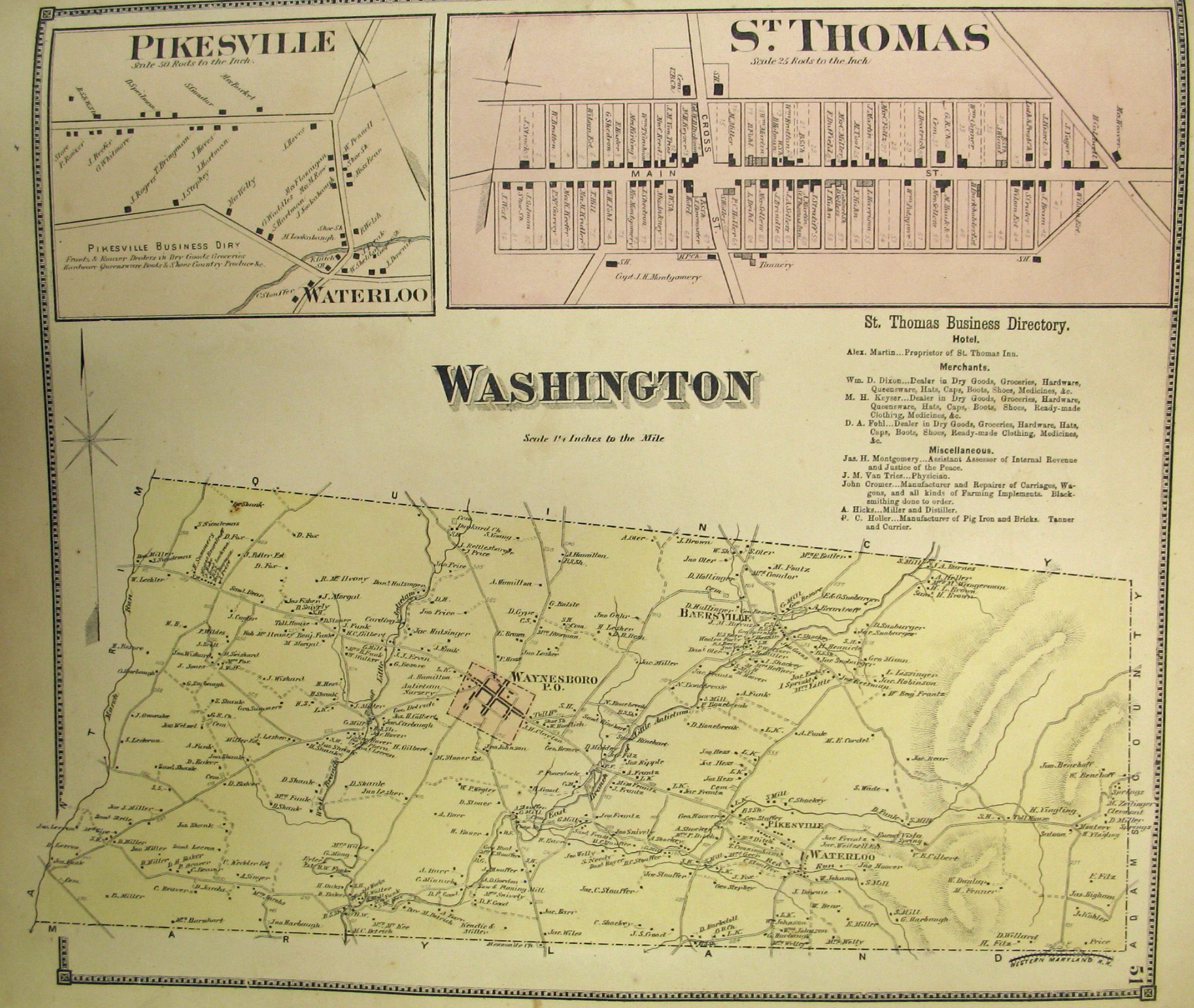
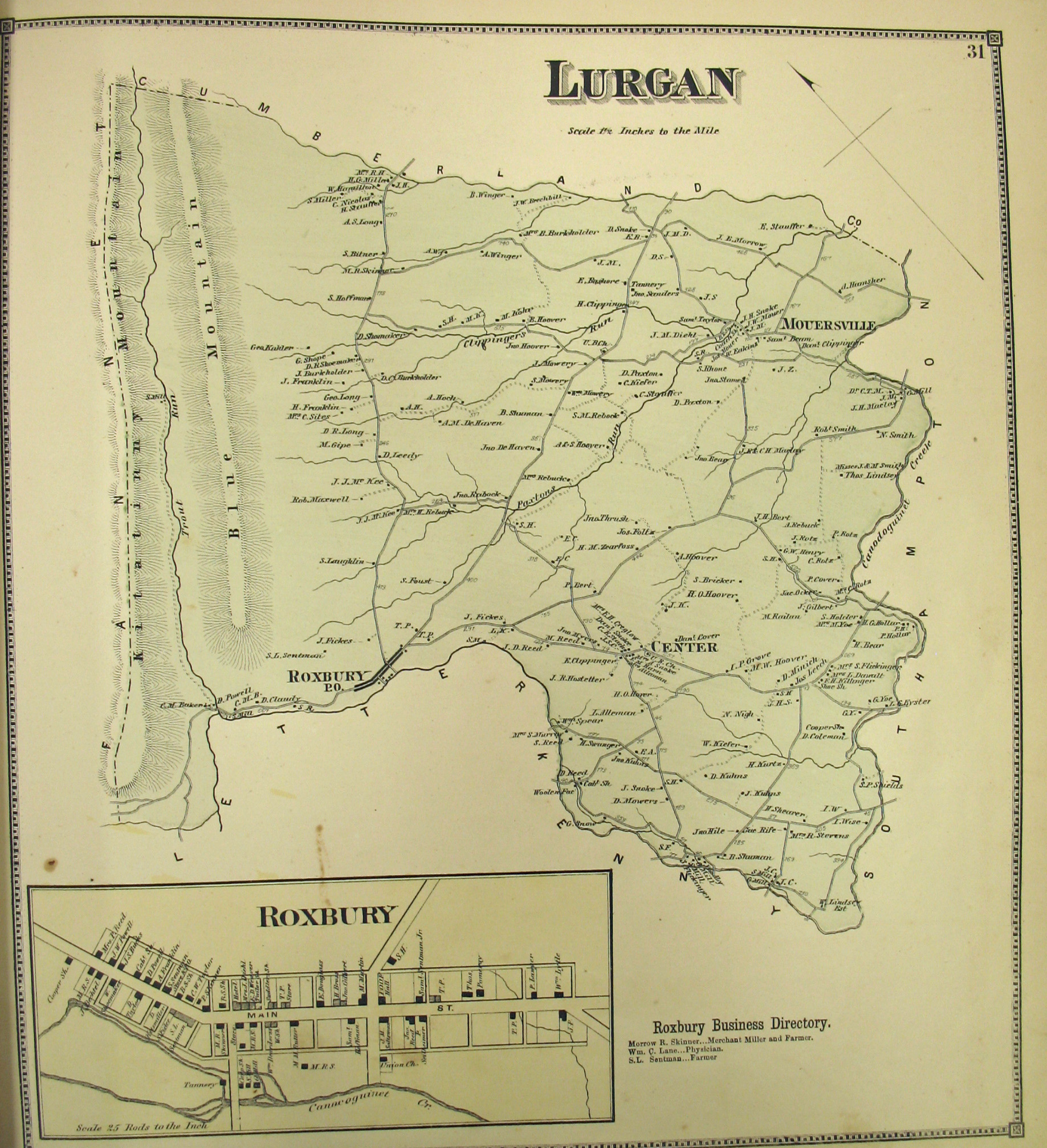
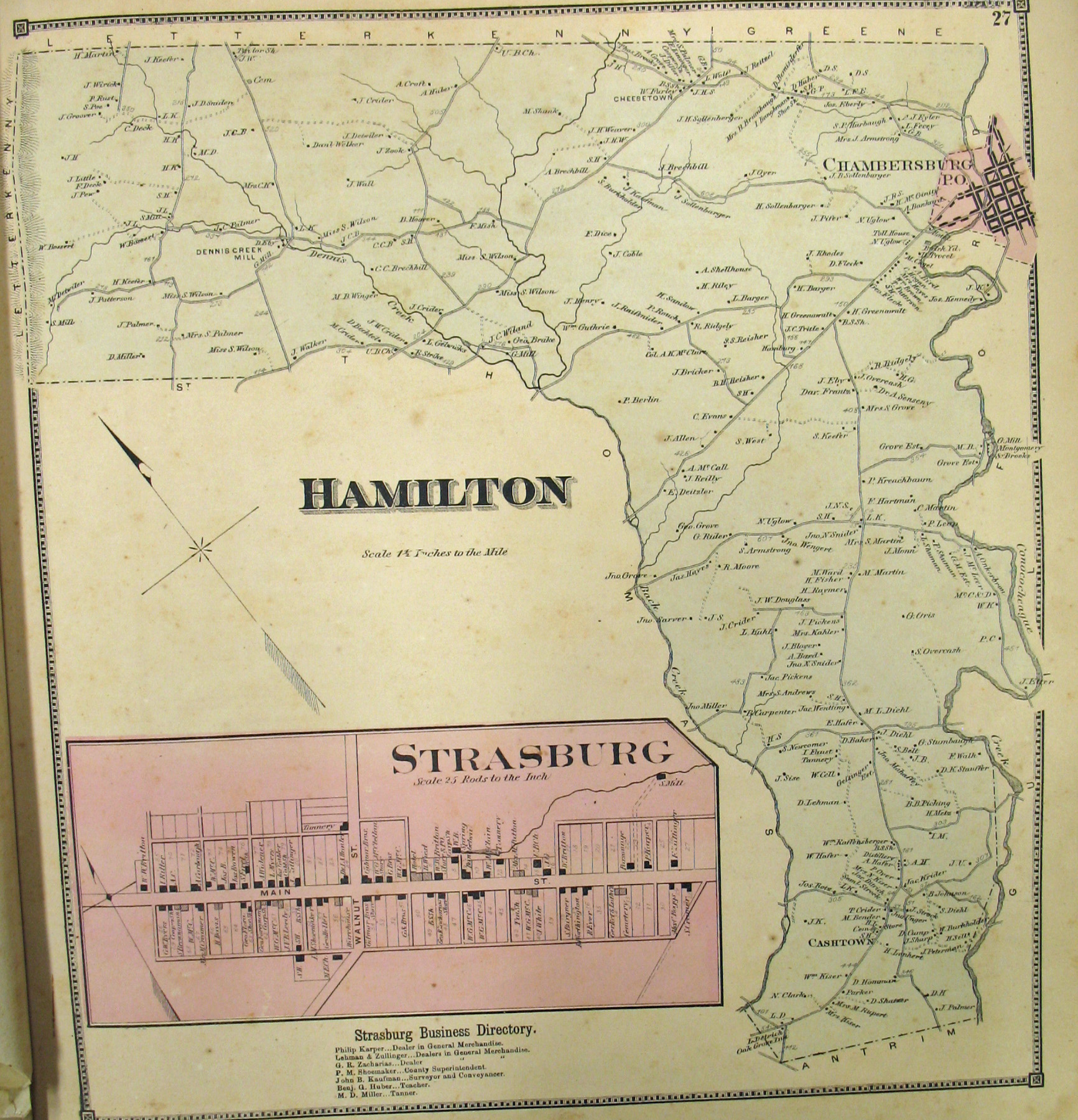
In lieu of being able to bring you Township Warrantee Maps of the earliest settlers, we are posting free, downloadable images of the Atlas of Franklin County, Pennsylvania, From actual Surveys under the direction of D. G. Beers published by Pomeroy & Beers in 1868. We hope that it will be a useful tool for locating your Franklin County families when coupled with the 1860 and 1870 censuses and published county histories.
Speaking of the censuses and county histories, the Franklin County USGenWeb Archives has a wealth of information, and don’t overlook Jim Houpt’s outstanding indexing project of resources in the Fendrick Library in Mercersburg. Several online histories have been published: Bates’ 1887 History of Franklin County, Pennsylvania (1,110 pages), Rupp’s 1846 History and Topography of Dauphin, Cumberland, Franklin, Bedford, Adams, and Perry Counties, and Nevin’s Centennial Biography, Men of Mark of Cumberland Valley, PA, 1776-1876.
