Ancestor Tracks is committed to becoming a one-stop resource for researchers of early Pennsylvania landowners. In addition to publishing our own books, we are posting images of 19th century maps and atlases that we personally took in the Library of Congress. Our goal is to post landowner maps, or links to other websites with landowner maps, for every county in the state.
Original Land Owners
The state of Pennsylvania began platting the exact metes-and-bounds tracts of the earliest landowners, township-by-township, starting in 1907, but the Land Office only completed about 1/3 of the state before the project ended. Unfortunately, Pennsylvania did not plat the tracts of the earliest landowners of Lycoming County.
If your ancestor was a first landowner in the county, the only way to find the date, book and page of the original warrant, survey, and patent for your ancestor is to search for him or her in the correct alphabetical section and then chronologically through county Warrant Registers on the Pennsylvania State Archives website where each page of each county’s ledger is a separate pdf file, or download and save to your computer the entire set of 67 county Warrant Registers plus 3 pre-1733 ledgers called First Landowners of PA: Colonial and State Warrant Registers in the PA Archives, Harrisburg, 1682-ca 1940 ($35). Once you have found the information, you can access the free online surveys, and you can order copies of the original documents from the Pennsylvania State Archives in Harrisburg using their order form.
If you cannot find an original landowner’s name in the Warrant Registers, the next place to look is in Pennsylvania’s index to Patent Registers ($35). Within an index covering the relevant years, the names are grouped alphabetically by the first letter of the patentee’s surname, then grouped by volume number of Patent Book, and finally arranged chronologically by date of patent. Thus, you have to look through the entire alphabetical section (which may be as little as one page to as many as 50) to be sure you don’t miss anyone.
Please note that these land transfers predate the deed books located in each county because they deal with the first transfer of land to private individuals from Pennsylvania’s colonial or state government. Once the land passed into the hands of a private owner, any subsequent transfer of the land was recorded as deeds in the county courthouse as it existed at that time.
Lycoming County was formed from Northumberland County in 1795. Thus, both of these counties should be checked for warrants, deeds, wills, etc.
To learn about the Pennsylvania Land Acquisition process that England set up to distribute colonial land (which basically continues today), as well as the boundary disputes (between Pennsylvania and Maryland, Pennsylvania and Virginia, and Pennsylvania and Connecticut), Revolutionary War Donation and Depreciation land, and land opened through treaties with Indians, see our Land Acquisition page.
19th-Century Residents
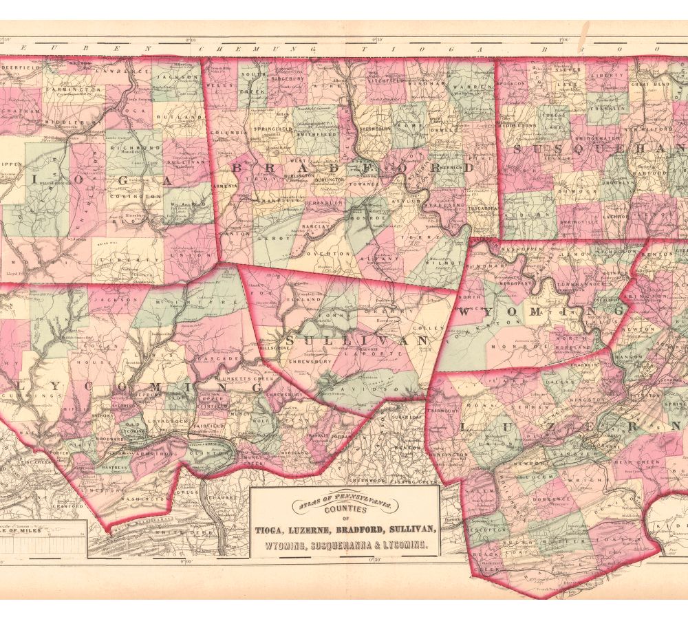
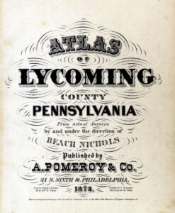
As we have done for numerous Pennsylvania counties (hover over each county on the PA map to see what is available for each county) and in lieu of being able to bring you Township Warrantee Maps of the earliest settlers, we are posting images from 1873 Atlas of Lycoming County Pennsylvania from Actual Surveys by and under the direction of Beach Nichols published by A. Pomeroy & Co. This atlas is located in the Library of Congress Geography and Map Division Washington, D.C. Unfortunately, because of the quality of the original atlas, we were unable to produce completely clear images but we hope that you will find it a useful tool for when coupled with the 1860, 1870 and 1880 census and published county histories. Speaking of histories, a digital version of the 1929 History of Lycoming County by Col. Thomas W. Lloyd is at the Penn State University Library Digital Collections, and the same History of Lycoming County is currently being transcribed by the Foulkrod Research Group along with other resources. Also, the 1892 History of Lycoming County, Pennsylvania edited by John F. Meginness can be downloaded for free from archive.org.