Ancestor Tracks is committed to becoming a one-stop resource for researchers of early Pennsylvania landowners. In addition to publishing our own books, we are posting images of 19th century maps and atlases that we personally took in the Library of Congress. Our goal is to post landowner maps, or links to other websites with landowner maps, for every county in the state.
Original Land Owners
The state of Pennsylvania began platting the exact metes-and-bounds tracts of the earliest landowners, or warrantees and patentees, starting in 1907. However, the Land Office only completed about 1/3 of the state before the project ended. Unfortunately, Pennsylvania did not plat the tracts of the earliest landowners of Montour County.
The only way to find the date, book and page of the original warrant, survey, and patent for your ancestor is to do what the state draftsmen did to create their warrantee maps of other counties. They searched through the relevant county Warrant Register, and that of its parent counties, now posted on the Pennsylvania State Archives website where each page of each county’s ledger is a separate pdf file, or download and save to your computer the entire set of 67 county Warrant Registers plus 3 pre-1733 ledgers called First Landowners of PA: Colonial and State Warrant Registers in the PA Archives, Harrisburg, 1682-ca 1940 ($35). Once you have found the information, including the Survey Book and page number, you can access the free online surveys. You can also order copies of the original documents from the Pennsylvania State Archives in Harrisburg using their order form.
If you cannot find an original landowner’s name in the Warrant Registers, the next place to look is in Pennsylvania’s index to Patent Registers ($35). Within an index covering the relevant years, the names are grouped alphabetically by the first letter of the patentee’s surname, then grouped by volume number of Patent Book, and finally arranged chronologically by date of patent. Thus, you have to look through the entire alphabetical section (which may be as little as one page to as many as 50) to be sure you don’t miss anyone.
To learn about the Pennsylvania Land Acquisition process that England set up to distribute colonial land (which basically continues today), as well as the boundary disputes (between Pennsylvania and Maryland, Pennsylvania and Virginia, and Pennsylvania and Connecticut), Revolutionary War Donation and Depreciation land, and land opened through treaties with Indians, see our Land Acquisition page.
Keep in mind that Montour County was created from Columbia County in 1850. Columbia Co. was created in 1813 from Northumberland, and the portion of Northumberland which became Columbia was originally part of Berks and Northampton Counties until 1772. Thus, all of these counties should be checked for warrants, deeds and wills, etc., depending on when your ancestor settled here. The details in the Warrant Register indexes include several pieces of extremely important information for genealogists: (1) the name of the warrantee; (2) size of the tract; (3) date of the warrant (or order which was issued by the colonial or state Land Office to have the tract surveyed for the warrantee); (4) date the survey was returned to the Land Office; (5) name of the patentee who received final title from the state after the survey was returned; (6) Warrant Register and page number where the warrant was registered; and (7) the Survey Book and page number onto which the original survey was copied.
These land transfers predate the deed books located in each county because they deal with the first transfer of land to private individuals from Pennsylvania’s colonial or state government. Once the land passed into the hands of a private owner, any subsequent transfer of the land was recorded as deeds in the county courthouse as it existed at that time.
19th-Century Residents
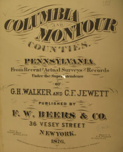
As we have done for numerous Pennsylvania counties (hover over each county on the PA map), we are posting free, downloadable township images of the 1876 Atlas of Columbia and Montour Counties. We hope that you will find this atlas a useful tool to be used in conjunction with the 1860, 1870 and 1880 census records, as well as downloadable county histories: J. H. Battle’s 1887 History of Columbia & Montour Counties, Pennsylvania, and the two-volume Historical and Biographical Annals of Columbia and Montour Counties published by H. H. Beers in 1915 (Volume I and Volume II).
Also check out Cummings’ 1860 Map of Columbia and Montour Counties in the Leventhal Map Collection at Boston Public Library. If you click on the map it will open and then you can use your cursor wheel to zoom in and see every detail.


 Click on the township of your choice below. Once the images are loaded, they can be enlarged by clicking on them. If an image doesn’t enlarge, right-click on it and choose “Open Image in New Tab.” When it is opened in a new tab, you will be able to zoom in. You can also save the images.