
Landowner Maps for Tioga County

Ancestor Tracks is committed to becoming a one-stop resource for researchers of early Pennsylvania landowners. In addition to publishing our own books, we are posting images of 19th century maps and atlases that we personally took in the Library of Congress. Our goal is to post landowner maps, or links to other websites with landowner maps, for every county in the state.
Original Land Owners
The state of Pennsylvania began platting the exact metes-and-bounds tracts of the earliest landowners, township-by-township, starting in 1907. They only completed these Warrantee Maps for about 1/3 of the land mass of Pennsylvania, and Tioga County is one of the completed counties. The Pennsylvania State Archives has been so kind as to post these images online (scroll below the 1875 atlas images for links to these Tioga County Township Warrantee Maps) but they are not indexed.
Tioga County was created from Lycoming County in 1804. Originally, the area that became Tioga County was annexed to Northumberland County in 1785. It became part of Lycoming when Lycoming ws created in 1795. These dates are important because warrants, wills, deeds, etc. were filed in the county as it existed at that time.
Also, the entire northern 1/3 of Pennsylvania was disputed by Connecticut and by Native Americans. Indians finally gave up their claims to Susquehanna County and a huge swath of Pennsylvania through the “New Purchase” of 1768. Those who purchased under the New Purchase had their land applications entered into the New Purchase Register.
Note that this area was part of the Last Purchase of 1784 (see the Last Purchase Register), and vast areas of land were first purchased from the commonwealth of Pennsylvania by land speculators before being resold to settlers. See the explanation of the Last Purchase on our Elk County page. To learn about the Pennsylvania Land Acquisition process that England set up to distribute colonial land (which basically continues today), as well as the boundary disputes (between Pennsylvania and Maryland, Pennsylvania and Virginia, and Pennsylvania and Connecticut), Revolutionary War Donation and Depreciation land, and land opened through treaties with Indians, see our Land Acquisition page.
The draftsmen at the Pennsylvania Land Office also used the Warrant and Patent Registers to create the Warrantee Maps. They searched each county and parent county, then each alphabetical section chronologically, in the set of 67 county Warrant Registers plus 3 pre-1733 ledgers called First Landowners of PA: Colonial and State Warrant Registers in the PA Archives, Harrisburg, 1682-ca 1940 ($35) which can now be downloaded and saved to your computer. (Free images are also posted on the Pennsylvania State Archives website where each page of each county’s ledger is a separate pdf file). The Pennsylvania State Archives has posted the online survey books (both front and back side of each survey have been digitized) and you can order copies of the original documents from the Pennsylvania State Archives in Harrisburg using their order form. The draftsmen also searched Pennsylvania’s index to Patent Registers ($35). Within an index covering the relevant years, the names are grouped alphabetically by the first letter of the patentee’s surname, then grouped by volume number of Patent Book, and finally arranged chronologically by date of patent. Thus, the entire alphabetical section must be searched (which may be as little as one page to as many as 50) so as not to miss anyone.
19th-Century Residents
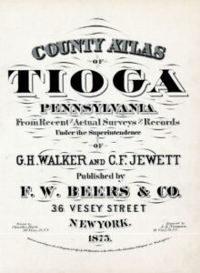
In addition to links to the Warrantee Maps, we are posting free, downloadable images from 1875 County Atlas of Tioga, Pennsylvania From recent and actual surveys and records under the superintendence of G. H. Walker and C. F. Jewett (New York: F. W. Beers and Company, 1875. We hope this landowner map will be useful when coupled with the 1860, 1870 and 1880 censuses and published county histories such as the transcribed 1883 History of Tioga County, Pennsylvania with Illustrations, Portraits & Sketches of Prominent Families and Individuals published by W. W. Munsell & Co. (page images of this book are on the Internet Archive); McKnight’s 1905 A Pioneer Outline History of Northwestern Pennsylvania, Embracing the Counties of Tioga, Potter, McKean, Warren, Crawford, Venango, Forest, Clarion, Elk, Jefferson, Cameron, Butler, Lawrence, and Mercer; and the 1897 History of Tioga County, Pennsylvania by R. C. Brown & Co. (also available as a downloadable .pdf version on the Internet Archive).
Note that the links to the county histories will take you to Joyce Tice’s stunningly comprehensive website Tri-Counties Genealogy & History which contains, as she writes, “17,000 pages of resource materials and tools for Tioga and Bradford Counties in PA and Chemung County in NY.” Other publications in her “Tri-Counties Online Research Library” include military histories, township histories, historic newspapers, and a myriad of other resources. She has also posted an excellent chart showing the formation of townships with links to individual pages for each township containing extensive resources. DO NOT MISS HER WEBSITE if you are researching in Bradford County or Tioga County, PA (or Chemung County, NY).
Other publications in her “Tri-Counties Online Research Library” include military histories, township histories, historic newspapers, and a myriad of other resources.
We posted these images, the best that we could make onsite, years ago. In the interim, the University of Alabama has posted better images of the 1875 atlas but we are leaving our images online because they are easier to use. If you can’t read an entry on our images, consult the Alabama images.
Click on the township of your choice below. Once the images are loaded, they can be enlarged by clicking on them. If an image doesn’t enlarge, right-click on it and choose “Open Image in New Tab.” When it is opened in a new tab, you will be able to zoom in. You can also save the images.
While the map in the Library of Congress, is in the public domain the images we have taken belong to us and are not to be used for commercial use. For those wishing to use them for personal use (including illustrating a family history you are working on), we give permission to use them, but we would appreciate attribution to Ancestor Tracks. It takes much time and effort to locate, process, edit, and post these and the many other county images we have posted, so we appreciate this courtesy.
To put Tioga County in perspective, here is an 1872 map of the surrounding area
1875 Township Maps
Bloss Township
Brookfield Township (formerly Mink Hollow)
Charleston Township
Chatham Township
Clymer Township (formerly Middletown)
Covington Township
Deerfield Township
Delmar Township (one of the two “mother” townships)
Duncan Township
Elk Township
Farmington Township
Gaines Township
Hamilton Township (formerly Morris Run)
Jackson Township
Lawrence Township
Liberty Township
Middlebury Township
Morris Township
Osceola Township (formed in 1857 from the now extinct Elkland Township)
Nelson Township (formed in 1857 from the now extinct Elkland Township)
Richmond Township
Rutland Township
Shippen Township
Sullivan Township
Tioga Township (one of the two “mother” townships)
Union Township
Ward Township
Westfield Township
Boroughs, Towns, and Villages
Academy Corners
Antrim
Austinville
Brookfield Hollow
Blossburg
Brooklyn
Canoe Camp
Covington
Cowanesque Valley
Daggetts Mills
East Charleston
Elkland Borough (formed in 1850 from Elkland Township which no longer exists)
Gaines
Henslertown
Holidaytown
Jobs Corners
Keeneyville
Knoxville
Lambs Creek
Lawrenceville
Little Marsh
Mainsburg
Mainsburg Borough
Mansfield Borough
Millerton
Nauvoo
Niles Valley
Ogdensburgh
Roseville
Round Top
Sabinsville
Shortsville
Somers Lane
Stokesdale
Stony Forks
Wellsborough
Westfield Borough (shown as Priestville in the early Bingham Estate map)
Tutorial: Note that the tract numbers shown on the 1875 atlas above correspond with the tract numbers on the Warrantee Maps below. Compare the atlas version of Elk Township posted above with the Warrantee Map of Elk Township below, for example, and you will see that Tract #2579 at the top of Elk Township is labeled “S.X.B” on the atlas. On the Township Warrantee Map below, it becomes clear that it was originally purchased (or warranted) on 12 Dec 1792 by land speculator Wilhem Willink, et. al., and contained 1002 acres and allowance (6% of the land, the “allowance,” was officially set aside for governmental purposes such as for roads). Final title, or “Patent,” was not transferred until 1874, over 80 years later, when Silas X. Billings patented it and his transaction was recorded in Patent Book H72, pg. 672 as shown on the Warrantee Map. The numbers on the tracts in both cases refer to numbers assigned to the tracts purchased under the 1784 “Last Purchase” and the sale warrants are recorded in the Last Purchase Register at the Pennsylvania Archives in Harrisburg. The warrants can be searched by scrolling through the pages under the first initial of the surname of the purchaser. Thus, Tract #2579 appears on pg. 48 (under “W”) which verifies that it was granted on 12 Dec 1792 to “Willink, Wilhem and others” with an estimated size of 900 acres. The survey was returned for patenting to Silas X. Billings on 20 Apr 1874 with an actual size of 1002 acres. It confirms that the Patent was recorded in Patent Register H72, pg. 672 (since the patentee was Silas Billings, his patent was indexed under the letter “B” in the Patent Index Registers). The last column in the Last Purchase Register shows that the survey is recorded in Survey Book D7, pg. 127, which has been posted online with all other surveys by the Pennsylvania Archives. See the explanation of the Last Purchase of 1784 on our Elk County page and a map showing the Last Purchase counties in yellow).
In addition to using the Last Purchase Ledger, Land Office draftsmen searched in county Warrant Registers. To find the date, book and page of the original warranat, survey, and patent, search in the correct alphabetical section and then chronologically through county Warrant Registers on the Pennsylvania State Archives website where each page of each county’s ledger is a separate pdf file, or download and save to your computer the entire set of 67 county Warrant Registers plus 3 pre-1733 ledgers called First Landowners of PA: Colonial and State Warrant Registers in the PA Archives, Harrisburg, 1682-ca 1940 ($35). Once you have found the information, you can access the free online surveys, and you can order copies of the original documents from the Pennsylvania State Archives in Harrisburg using their order form. Please note that these land transfers predate the deed books located in each county because they deal with the first transfer of land to private individuals at the state level.
If you cannot find an original landowner’s name in the Warrant Registers, the next place to look is in Pennsylvania’s index to Patent Registers ($35). Within an index covering the relevant years, the names are grouped alphabetically by the first letter of the patentee’s surname, then grouped by volume number of Patent Book, and finally arranged chronologically by date of patent. Thus, you have to look through the entire alphabetical section (which may be as little as one page to as many as 50) to be sure you don’t miss anyone.
As mentioned above, we are including links to the Warrantee Maps for each township which were drafted by the Pennsylvania Land Office. They have been scanned and posted online by the Pennsylvania Archives.
Tioga Co. Township Warrantee Maps
in the Pennsylvania State Archives, Harrisburg
(First people to receive land from the PA government)
Township Warrantee Maps
Bloss
Brookfield Township
Charleston Township
Chatham Township
Clymer Township
Covington Township
Deerfield Township
Delmar Township
Duncan Township
Elk Township
Farmington Township
Gaines Township
Hamilton Township
Jackson Township
Lawrence Township
Liberty Township
Middlebury Township
Morris Township
Nelson and Elkland Townships
Putnam Township (formerly Covington Borough which chose to become a township in 1891)
Richmond Township
Rutland Township
Shippen Township
Sullivan Township
Tioga Township
Union Township
Ward Township
Westfield Township