Our goal at Ancestor Tracks is to publish maps and land ownership information allowing researchers to place more precisely the locations where our ancestors lived.
Original Land Owners
The state of Pennsylvania began platting the exact metes-and-bounds tracts of the earliest landowners, township-by-township, starting in 1907. Fortunately for Venango County researchers, the Pennsylvania Land Office completed excellent Township Warrantee Maps of Venango County and the Pennsylvania State Archives has graciously posted them online. We are posting links to each of these warrantee maps below the images of the 1857 and 1865 atlases.
To learn about the Pennsylvania Land Acquisition process that England set up to distribute colonial land (which basically continues today), as well as the boundary disputes (between Pennsylvania and Maryland, Pennsylvania and Virginia, and Pennsylvania and Connecticut), Revolutionary War Donation and Depreciation land, and land opened through treaties with Indians, see our Land Acquisition page.
Venango County was part of the “Last Purchase” of 1784. The Penns did not sell land until they received it through Indian treaties, and thus the land which would become Venango County was not available for purchase until the land was acquired through the Treaty of 1784 after the Revolutionary War. The vast area of northwest Pennsylvania was thus opened up for settlement through this “Last Purchase.” About 20 of today’s counties were originally part of this land. At first the price was set relatively high, and few tracts sold for that amount. In fact, a letter addressed by Benjamin Franklin to the Supreme Executive Council on 23 Feb 1787 says, “We are convinced that it will be of advantage to the State to lower the price of land within the late Indian purchase; only eight warrants have been taken out for lands these six months passed.” (Colonial Records, vol. xv., pg. 167). The price of the land was thus duly reduced, and it was again reduced in 1792 because sales were not increasing much. Finally, the lower price induced many large land purchasers to apply for huge tracts.
After the Revolutionary War, the western portion of the county was part of the Donation Lands so be sure to check for potential military service of these settlers. The Donation Lands program was designed to induce men to stay in service until the end of the war when they would be given land as a bonus for their service. Distribution of the tracts was through a lottery system. Many men decided not to move to this wilderness and sold their warrants, but many others actually took up land here based on their Donation Certificates.
Venango County was created in 1800 from Allegheny and Lycoming Counties. Going backward, the southern half of Allegheny County was originally part of Cumberland County (1750-1771), then Bedford County (1771-1778), and then part of Westmoreland County (1788-1800) and part of Washington County (1781-1800). The northern half of Allegheny County was annexed to Northumberland County in 1785. Similarly, Lycoming was carved from Northumberland County in 1795. Thus, all of these counties should be checked for deeds and wills, etc.
When Venango County was created in 1800, Clarion County was contained within it and did not split off and became its own county until 1839.
19th-Century Residents
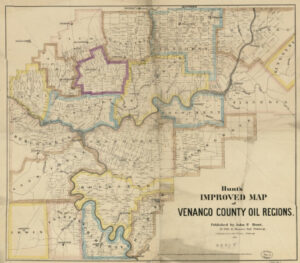
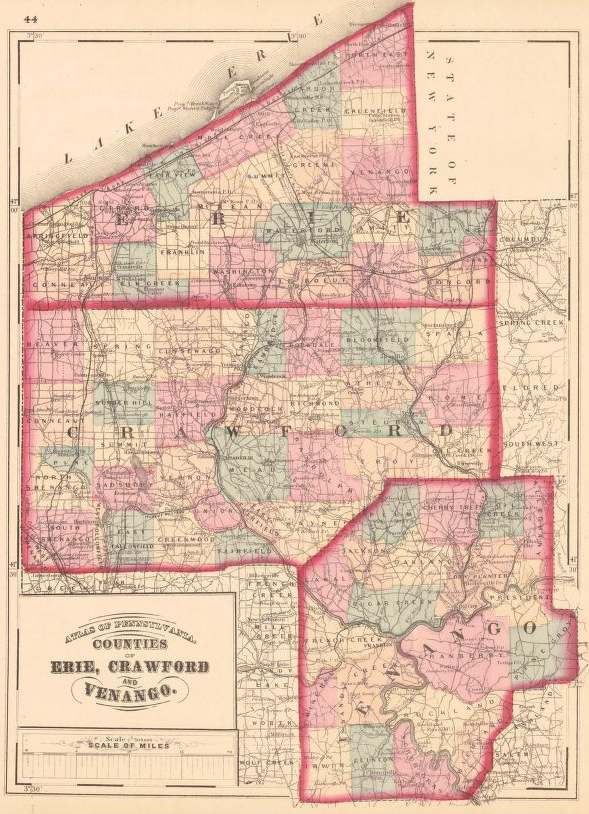
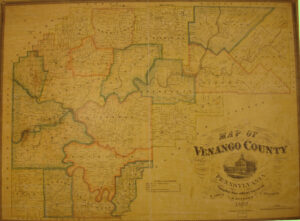
As we have done for numerous Pennsylvania counties (hover over each county on the PA map), we are posting free, downloadable township images of two maps of Venango County, one published in 1857 and one published in 1865. These maps are physically located in the Map Room of the Library of Congress. We hope that they will be useful tools for locating your Venango County families when coupled with the 1850 – 1880 censuses and published county histories: (1) Herbert Bell’s 1890 History of Venango County, Pennsylvania: Its Past and Present; (2) McKnight’s 1905 A Pioneer Outline History of Northwestern Pennsylvania, Embracing the Counties of Tioga, Potter, McKean, Warren, Crawford, Venango, Forest, Clarion, Elk, Jefferson, Cameron, Butler, Lawrence, and Mercer; and (3) Babcock’s 2-volume Venango County, Pennsylvania: Her Pioneers and People published by H. H. Beers in 1919 (also downloadable from Google Books: Volume I and Volume II).

 Click on the township of your choice below. Once the images are loaded, they can be enlarged by clicking on them. If an image doesn’t enlarge, right-click on it and choose “Open Image in New Tab.” When it is opened in a new tab, you will be able to zoom in. You can also save the images.